MONTHLY CLIMATOLOGICAL SUMMARY for FEBRUARY 2010
CONDITIONS DAY of
Month: 1 2 3 4 5 6 7 8 9 10 11 12 13 14 15 16 17 18 19 20 21 22 23 24 25 26 27 28
NAME: 3270 Nowell   CITY: West Juneau   STATE: Alaska
ELEV:    97 ft  LAT: 58° 17' 33" N  LONG: 134° 25' 37" W


TEMPERATURE (°F), RAIN  (in), WIND SPEED (mph), SNOW (in). Snowfall from 21:00 - 21:00, all others Midnight to Midnight.

                                      HEAT  COOL        AVG                      WIND       SNOW
    MEAN                              DEG   DEG         WIND                DOM  RUN        ON(1)
DAY TEMP  HIGH   TIME   LOW    TIME   DAYS  DAYS  RAIN  SPEED HIGH   TIME   DIR  (mi)  SNOW GRND WEATHER
-----------------------------------------------------------------------------------------------------------------------------------------------------
 1  34.5  35.9  12:15p  32.7   6:50a  30.5   0.0  0.03   0.0   2.0  12:05a    W   0.00  0.0  0.0 Brks-SltBrk Cd/VryLtSpr-LtSpr-Mst-VryLtDriz-FewLulls
 2  35.0  36.9  12:55p  33.4  11:25p  30.0   0.0  0.02   0.0   2.0   2:20p    W   0.00  0.0  0.0 Cd/Spr-LtRn Foggy-Cd/LoFog-Cds/FewSpr Cd-LoCds/OccSp
 3  34.1  35.3  11:50a  33.2   2:00a  30.9   0.0  0.05   0.6   8.0   4:15p  SSE  13.05 TRCE  0.0 Cldy/VryLtSn&Sn-Rn/VryLt-ExtmLtSpr Cld/Sn-Rn Cld/Spr
 4  35.0  40.5  12:40p  31.2  11:55p  30.0   0.0  0.02   0.3  10.0  10:15a  SSE   7.34  0.0  0.0 Cd/Sp-VryLtRn Brks MCd PCd MCd Cd Cd/Rn Cd Brks MClr
 5  37.8  44.9   3:50p  31.2  12:05a  27.2   0.0 TRACE   0.8  14.0   6:45a  WSW  18.75  0.0  0.0 Cld-OccHintsBlu Cld/Spr Cd-OccHintsBlu Cd-Brks PCld
 6  40.5  47.6   4:30a  37.0   1:40a  24.5   0.0  0.32   1.3  21.0   9:25a  SSE  30.42  0.0  0.0 Cld LtWnd Cld/VryLtRn-Spr-Rn-VryLtDriz-Spr-FewLulls
 7  41.3  43.2   7:25p  39.9  12:05a  23.6   0.0  0.14   1.8  16.0   2:25a  SSE  43.90  0.0  0.0 Cld/VryLtSpr-LtRn Cld Cld/RnShrs Cld Cld/VryLtRn
 8  36.1  40.5  12:15a  31.9  11:55p  28.9   0.0  0.02   0.8  11.0  12:25a  WSW  18.26  0.0  0.0 Cd/LtRn Cd VarCd-PCd&Brks/FewVryLtR-Drz-Sn-SpShrs Cd
 9  34.4  37.2   1:35p  31.5  12:30a  30.6   0.0 TRACE   0.1   9.0   8:05p    E   3.39  0.1  0.0 Cldy/VryLtSn Cld-ThnnerSpots-Areas Cld-HntsBlue Cldy
10  36.8  40.5  12:45p  33.2   8:25a  28.2   0.0  0.00   0.4  14.0  11:30p  WSW   8.92  0.0  0.0 Cd Sm-TnyBrks MCd Sm-TnyBrks M/PCd Cd-VarBrks MCd
11  38.3  43.3  12:20p  34.9   1:25a  26.7   0.0  0.00   1.1  31.0  10:15a  WSW  25.89  0.0  0.0 Cd-OccThnnrCds Lt-Wndy HntsBlu Cd Brks-SmClrAreas Cd
12  36.3  41.6   3:30p  29.8   8:10a  28.5   0.0 TRACE   0.4  10.0  12:35p  WSW   9.01  0.0  0.0 PCd MClr PCd VryThn-ThnshCds-FiltBlu Ovcst Cd Cd/Spr
13  42.1  48.6   6:50p  33.2   1:20a  22.9   0.0  0.02   5.2  38.0   3:55p  ENE 125.04  0.0  0.0 Cd Brks-HntsBrks Brz-Wndy Cd-Ovcst Cd/Sp Cd Cd/RnShr
14  41.2  45.1  10:35a  39.2   1:40a  23.8   0.0  0.13   2.2  21.0  11:00a  SSE  51.98  0.0  0.0 Cd/LtRn Cd MCd OccLt-Brz Cd/FewSp Cd/SpToRn-FewLulls
15  42.1  46.7  11:00p  37.6   8:15a  22.9   0.0  0.05   3.1  29.0   9:10p    E  75.17  0.0  0.0 Cd/Rn Cd-FltBrks Cd-LtRn VarCdToPCd-Brks Brz-Wndy Cd
16  40.4  45.5  12:20a  37.0   7:20a  24.6   0.0  0.11   2.2  26.0   1:10a  SSE  53.77  0.0  0.0 Brzy-Windy Cd Cd/VryLtSprToRain Cd Cd/OccLtRn-Mst
17  38.2  40.6  12:05a  33.4  11:35p  26.8   0.0  0.24   0.8  11.0   8:55a  SSE  18.74  0.0  0.0 Cld Cld/ExtrmLtMist-Spr-Lt-VryLtRn-Driz-Rn Cld
18  32.7  38.8   1:40p  29.5  11:55p  32.3   0.0  0.00   0.1   6.0   5:50a    W   2.97  0.0  0.0 VarFog-PCdAbove DecrFg PCd MClr Clr Clr-FogHdngMnlnd
19  32.5  42.9  12:50p  27.8   7:00a  32.5   0.0  0.00   0.1   4.0   4:10a    W   3.04  0.0  0.0 Clr-VarFogOverChannel Frost Clr Clr-VarFogOveChannel
20  31.3  40.5   1:40p  27.2   7:30a  33.7   0.0  0.00   0.1   7.0  12:40p    W   1.46  0.0  0.0 Clr-VarFogOverChannel Frost Clr Clr-VarFogOveChannel
21  29.4  38.2   1:40p  24.8   6:05a  35.6   0.0  0.00   0.1   4.0   1:05a    W   1.93  0.0  0.0 Clear-VarFogOverChannel-Ovhd Frost Clear
22  30.0  39.1   1:35p  25.7   7:20a  35.0   0.0  0.00   0.1   7.0   8:30a  WSW   1.70  0.0  0.0 Clear Frost Fog-VarFog Clear MClr
23  34.2  40.9   3:25p  26.6   2:35a  30.8   0.0  0.03   0.1   7.0  12:40p  SSE   2.98  0.0  0.0 InCrCd Cd Cd-LtRnToSpr Cd-VarBrks PCd Cd PCd Brks Cd
24  36.6  39.5   1:40p  34.3   5:55a  28.4   0.0  0.08   0.1   8.0   3:45p  SSE   1.58  0.0  0.0 Cd/OccLtRn-Spr Cd Cd/Sp-VryLtRn-Drz-Mst Cd Cd/VryLtR
25  38.6  41.6   2:50p  35.3   3:35a  26.4   0.0  0.26   0.7  13.0   3:15a  SSE  16.75  0.0  0.0 Cld/Lt-VryLtRn-Rn-Spr-Driz Cld Cd/VryLtRn-Spr-Mst Cd
26  36.8  44.2   2:15p  30.3  11:10p  28.2   0.0 TRACE?  1.0  13.0  10:20a    W  24.10  0.0  0.0 TrcRn? Cd MClr Clr-VarFog MClr PCd VryThn-ThnshCd-Hz
27  34.9  39.5   8:40p  30.6  12:05a  30.1   0.0  0.08   0.4   9.0   9:05p  SSE   9.82  0.3  0.0 Fog-Cdy Cd Cd/Sn Cd/LtR-Drz-Sp-R Cd/OccSp-VryLtR-Mst
28  39.2  40.5   4:45p  38.3  10:15p  25.8   0.0  0.38   0.6  11.0   6:20p  SSE  13.70  0.0  0.0 Cldy/Rain-LtRn-Spr-VryLtRn
-----------------------------------------------------------------------------------------------------------------------------------------------------
    36.4  48.6    13    24.8    21   799.4   0.0  1.98   0.9  38.0    13    SSE 583.66  0.4

(1) As measured on Front Lawn
STATISTICS | DATA | GRAPHS | CONDITIONS - DAY of MONTH: 1 2 3 4 5 6 7 8 9 10 11 12 13 14 15
16 17 18 19 20 21 22 23 24 25 26 27 28 | TOP
AVERAGE Mean Temp:	36.4
AVERAGE High Temp:	41.4
MINIMUM High Temp:	35.3	3rd
MAXIMUM High Temp:	48.6	13th
AVERAGE Low Temp:	32.5
MINIMUM Low Temp:	24.8	21st
MAXIMUM Low Temp:	39.9	7th

MAX >= 90.0:		0
MAX >= 80.0:		0
MAX >= 70.0:		0
MAX <= 32.0:		0
MIN <= 32.0:		13	4th, 5th, 8th, 9th, 12th, 18th, 19th, 20th, 21st, 22nd, 23rd, 26th, 27th
MIN <=  0.0:		0

MAXIMUM Humidity (%):	97	18th @ 0552
MINIMUM Humidity (%):	35	15th @ 2127

MAXIMUM Pressure (mb):	1029.5	17th @ 1144
MINIMUM Pressure (mb):	993.5	24th @ 1314

TOTAL   Htg Deg Days:	799.4
AVERAGE Htg Deg Days:	28.6
MINIMUM Htg Deg Days:	22.9	15th
MAXIMUM Htg Deg Days:	35.6	21st
TOTAL Cool Deg Days:	0.0
Heat Base:  65.0  Cool Base:  65.0  Method: Integration

TOTAL   Precip.:	1.98
AVERAGE Precip.:	0.09	For days with Precipitation, including days with Trace
DAYS of Precip.:	21	All but: 10th, 11th, 18th, 19th, 20th, 21st, 22nd
MAXIMUM Precip.:	0.38	28th
MAXIMUM Rain Rate:	0.14	25th @ 0813
Days of Rain: 17 (>.01 in) 7 (>.1 in) 0 (>1 in)
TOTAL Snowfall:		0.4
DAYS of Snowfall:	3	3rd, 9th, 27th

AVERAGE High Wind:	12.9
MINIMUM High Wind:	2	1st, 2nd
MAXIMUM High Wind:	38	13th
WIND RUN (miles):	583.66

DAYS Full Sun at any time:	11	4th, 5th, 8th, 12th, 18th, 19th, 20th, 21st, 22nd, 23rd, 26th
DAYS OF Clear:			4	19th, 20th, 21st, 22nd
DAYS with Extensive Fog:	3	18th, 21st, 22nd
DAYS OF Cld or M Cld:		23
DAYS OF Rainbow:	0
DAYS OF Aurora:		0
DAYS OF Lightning:	0
DAYS OF Earthquake:	1	15th	4.4 or 4.6 ML, 0829 AST, 123 miles NW or WNW of Juneau


SUNDAY 2/28/07: DATA | Second Sunday in Lent
- 2100 AST: .33" of Rainfall to this point
today.
- 2050: Rain, Cloudy.
- 1950: Rain, Cloudy.
- 1850: Rain, Cloudy.
- 1800: .24" of Rainfall to this point
today.
- 1750: Light Rain, Cloudy, parts of the top
of the Mt. Juneau Ridge and of the top of
Mt. Roberts hidden by fog/clouds, some clouds
around the top of Mt. Juneau.
- 1650: Sprinkling, Cloudy, a few lower bits
and wisps.
- 1608: Sprinkling, Cloudy, murky around parts
of the top of Mt. Roberts, a few lower wisps
Channel side of Mt. Juneau.
- 1550: Very Light Rain, Cloudy, murky around
parts of the top of Mt. Roberts and parts
of the top of the Mt. Juneau Ridge, a few
lower wisps Channel side of Mt. Juneau.
- 1520: Light Rain, Cloudy, murky around parts
of the top of Mt. Roberts and in the Granite
Creek area, a few lower bits and wisps.
- 1500: .21" of Rainfall to this point
today.
- 1450: Sprinkling, Cloudy, a few lower clouds,
bits and wisps.
- 1435: Very Light Rain, Cloudy, some lower
wisps Channel side of Mt. Juneau and a few
clouds around the top of Mt. Roberts.
- 1346: Very Light Rain, Cloudy, a few wisps
on the Channel side of Mt. Juneau and a few
around the upper part of Mt. Roberts,
- 1250: Light Rain, Cloudy, upper part of Mt.
Roberts hidden by clouds, clouds over some
of the Channel slope of Mt. Juneau, inner
Gold Creek valley slightly to partially obscured,
a few wisps in Last Chance Basin.
- 1200: .16" of Rainfall to this point
today.
- 1150: Rain, Cloudy, upper part of Mt. Roberts
hidden by clouds, upper part of the Mt. Juneau
Ridge substantially obscured-hidden with
the remainder of the inner Gold Creek valley
partially obscured, clouds over some of the
Channel slope of Mt. Juneau.
- 1118: High Rain Rate of .05" of Rain
per hour.
- 1050: Rain, Cloudy, much of the top of Mt.
Roberts and most of the inner Gold Creek
valley substantially obscured-hidden, remainder
of the inner Gold Creek valley partially
obscured, peak of Mt. Juneau obscured-hidden,
some lower wisps Channel side of Mt. Juneau.
- 1020: Sprinkling/Very Light Rain, Cloudy,
top of Mt. Roberts mostly hidden by clouds,
some clouds upper Channel side of Mt. Juneau.
- 0947: Light Rain after Rain, Cloudy, upper
part of the Mt. Juneau Ridge and parts of
the top of Mt. Roberts substantially obscured
- hidden, some small clouds on the Channel
side of the top of Mt. Roberts.
- 0850: Very Light Rain, Cloudy, parts of the
inner Gold Creek valley and of the top of
Mt. Roberts partially to substantially obscured
and hidden.
- 0750: Very Light Rain, Cloudy, part of the
very top of Mt. Juneau, parts of the top
of Mt. Roberts, and the inner Gold Creek
valley partially to substantially obscured
and hidden.
- 0720: Sprinkles, Cloudy.
- 0700: .08" of Rainfall to this point
today.
- 0650: Cloudy, inner Gold Creek valley partially
obscured from the precipitation there.
- 0635: Extremely Light Sprinkling, Cloudy.
- 0620: Very Light Sprinkling, Cloudy. .08"
of Rainfall to this point today.
- 0400 AST: High Rain Rate of .03" of
Rain per hour.
Sat. 2/27/07: DATA | 1805: Tsunami Advisory is Canceled for
the Coastal areas of Alaska from Sitka to
Seward - See 1805 Below | 2213: The Tsunami Advisory is Canceled
for the last area of Alaska - See 2213 Below | At 1530 AST Elfin Cove had a 0.3' Tsunami
- See Bulletin 21 Below | At 1527 AST Sitka had a 0.5' Tsunami -
See Bulletin 19 Below and at 1723 AST Sitka had a 0.7' Tsunami
- See Bulletin 25 Below | See 0604 Below for Estimated Tsunami Arrival
Times (Juneau at 4:35 PM AST) | 0452: Tsunami
Advisory first issued for the area including
SE Alaska - See 0521 Below | A Dense Fog Advisory was in effect until
9 AM AST this morning - See 0248 Below
- 2213 AST (Posted here at 0920 2/28):
WEAK51 PAAQ 280713
TSUAK1

BULLETIN
PUBLIC TSUNAMI MESSAGE NUMBER 25
NWS WEST COAST/ALASKA TSUNAMI WARNING CENTER PALMER AK
1113 PM PST SAT FEB 27 2010

...THE TSUNAMI ADVISORY IS CANCELED FOR THE COASTAL AREAS
   OF ALASKA FROM SAND POINT ALASKA TO ATTU ALASKA...

A DAMAGING TSUNAMI IS NOT EXPECTED ALONG THE COASTS OF THE U.S.
WEST COAST STATES - ALASKA AND BRITISH COLUMBIA. HOWEVER SOME OF
THESE AREAS MAY EXPERIENCE NON-DAMAGING SEA LEVEL CHANGES. AS
LOCAL CONDITIONS CAN CAUSE A WIDE VARIATION IN TSUNAMI IMPACT THE
ALL CLEAR DETERMINATIONS MUST BE MADE BY LOCAL AUTHORITIES.

A TSUNAMI HAS BEEN OBSERVED AT THE FOLLOWING SITES

 LOCATION                   LAT    LON     TIME        AMPL
 ------------------------  -----  ------  -------     -----------
 ADAK  AK                  51.9N  176.6W  0440UTC     0.38M/1.2FT
 ALITAK  AK                56.8N  154.3W  0516UTC     0.24M/0.8FT
 DUTCH HARBOR  AK          53.9N  166.5W  0313UTC     0.21M/0.7FT
 KING COVE  AK             55.1N  162.3W  0230UTC     0.62M/2.0FT
 KODIAK  AK                57.7N  152.5W  0221UTC     0.44M/1.4FT
 SAND POINT  AK            55.3N  160.5W  0409UTC     0.40M/1.3FT
 SEWARD  AK                60.1N  149.4W  0143UTC     0.38M/1.3FT
 SHEMYA  AK                52.7N  174.1E  0519UTC     0.27M/0.9FT
 SITKA  AK                 57.1N  135.3W  0223UTC     0.21M/0.7FT
 ATKA  AK                  52.1N  174.4W  0417UTC     0.40M/1.3FT

TIME - TIME OF MEASUREMENT
AMPL - TSUNAMI AMPLITUDES ARE MEASURED RELATIVE TO NORMAL SEA LEVEL.
       IT IS ...NOT... CREST-TO-TROUGH WAVE HEIGHT.
       VALUES ARE GIVEN IN BOTH METERS(M) AND FEET(FT).

AT 1034 PM PACIFIC STANDARD TIME ON FEBRUARY 26 AN EARTHQUAKE WITH
PRELIMINARY MAGNITUDE 8.8 OCCURRED
NEAR THE COAST OF CENTRAL CHILE.

THE PACIFIC TSUNAMI WARNING CENTER IN EWA BEACH HAWAII IS
CONTINUING ITS WARNING FOR AREAS OF THE PACIFIC OUTSIDE CALIFORNIA/
OREGON/ WASHINGTON/ BRITISH COLUMBIA AND ALASKA.
THIS WILL BE THE LAST WEST COAST/ALASKA TSUNAMI WARNING
CENTER MESSAGE ISSUED FOR THIS EVENT UNLESS CONDITIONS WARRANT
FURTHER INFORMATION.

TO REPEAT - NO TSUNAMI WARNING... NO WATCH AND NO ADVISORY IS IN
EFFECT FOR THE U.S. WEST COAST STATES - ALASKA AND BRITISH COLUMBIA.
SEE THE WEB SITE WCATWC.ARH.NOAA.GOV FOR BASIC TSUNAMI
INFORMATION... SAFETY RULES AND TSUNAMI TRAVEL TIMES.

$$
- 2100: .07" of Precipitation to this
point today. 5/16" - 3/8" Snowfall
today (from the morning) consisting of .03"
of Melted Precipitation. 0" of Snow
on the ground at 2100.
- 2050: Very Light Sprinkling, Cloudy.
- 1950: Cloudy.
- 1903:
WEAK51 PAAQ 280403
TSUAK1

BULLETIN
PUBLIC TSUNAMI MESSAGE NUMBER 22
NWS WEST COAST/ALASKA TSUNAMI WARNING CENTER PALMER AK
803 PM PST SAT FEB 27 2010

...A TSUNAMI ADVISORY IS IN EFFECT WHICH INCLUDES THE
   COASTAL AREAS OF ALASKA FROM KODIAK ALASKA TO ATTU
   ALASKA...

...THE TSUNAMI ADVISORY IS CANCELED FOR THE COASTAL AREAS
   OF CALIFORNIA FROM THE CALIFORNIA-MEXICO BORDER TO THE
   OREGON-CALIFORNIA BORDER...

...THIS MESSAGE IS INFORMATION ONLY FOR COASTAL AREAS OF
   OREGON - WASHINGTON - BRITISH COLUMBIA AND ALASKA FROM THE
   OREGON-CALIFORNIA BORDER TO SEWARD ALASKA...

...THE TSUNAMI ADVISORY IS CANCELED FOR THE COASTAL AREAS
   OF ALASKA FROM SEWARD ALASKA TO KODIAK ALASKA...

A TSUNAMI ADVISORY MEANS THAT A TSUNAMI CAPABLE OF PRODUCING
STRONG CURRENTS OR WAVES DANGEROUS TO PERSONS IN OR VERY NEAR
THE WATER IS IMMINENT OR EXPECTED.  SIGNIFICANT WIDESPREAD
INUNDATION IS NOT EXPECTED FOR AREAS UNDER AN ADVISORY.
CURRENTS MAY BE HAZARDOUS TO SWIMMERS... BOATS... AND COASTAL
STRUCTURES AND MAY CONTINUE FOR SEVERAL HOURS AFTER THE
INITIAL WAVE ARRIVAL.

AT 1034 PM PACIFIC STANDARD TIME ON FEBRUARY 26 AN EARTHQUAKE WITH
PRELIMINARY MAGNITUDE 8.8 OCCURRED
NEAR THE COAST OF CENTRAL CHILE.
THIS EARTHQUAKE HAS GENERATED A TSUNAMI WHICH COULD CAUSE DAMAGE
TO REGIONS IN A WARNING OR ADVISORY.
ESTIMATED TSUNAMI ARRIVAL TIMES AND MAPS ALONG WITH SAFETY RULES
AND OTHER INFORMATION CAN BE FOUND ON THE WEB SITE
WCATWC.ARH.NOAA.GOV.

A TSUNAMI HAS BEEN OBSERVED AT THE FOLLOWING SITES

 LOCATION                   LAT    LON     TIME        AMPL
 ------------------------  -----  ------  -------     -----------
 SAND POINT  AK            55.3N  160.5W  0257UTC     0.33M/1.1FT
 ADAK  AK                  51.9N  176.6W  0219UTC     0.25M/0.8FT
 ATKA  AK                  52.1N  174.4W  0232UTC     0.31M/1.0FT
 DUTCH HARBOR  AK          53.9N  166.5W  0311UTC     0.20M/0.7FT
 KING COVE  AK             55.1N  162.3W  0230UTC     0.60M/2.0FT
 KODIAK  AK                57.7N  152.5W  0246UTC     0.40M/1.3FT
 SEWARD  AK                60.1N  149.4W  0140UTC     0.33M/1.1FT
 ELFIN COVE  AK            58.2N  136.3W  0030UTC     0.08M/0.3FT
 PORT ANGELES  WA          48.1N  123.4W  2354UTC     0.15M/0.5FT
 SANTA BARBARA  CA         34.4N  119.7W  0116UTC     0.89M/2.9FT
 TSUNAMI AMPLITUDES CONTINUE TO DECREASE ALONG THE CALIFORNIA COAST
 AND THE ADVISORY FOR THE STATE IS CANCELLED. HOWEVER, POTENTIALLY
 DANGEROUS SURGES MAY STILL OCCUR AND CAUTION SHOULD BE
 TAKEN IN NEAR SHORE ACTIVITES.
 THE ADVISORY CONTINUES FOR ALASKA FOR THE TOWN OF KODIAK WEST
 TO ATTU.

TIME - TIME OF MEASUREMENT
AMPL - TSUNAMI AMPLITUDES ARE MEASURED RELATIVE TO NORMAL SEA LEVEL.
       IT IS ...NOT... CREST-TO-TROUGH WAVE HEIGHT.
       VALUES ARE GIVEN IN BOTH METERS(M) AND FEET(FT).

TSUNAMIS CAN BE DANGEROUS WAVES THAT ARE NOT SURVIVABLE. WAVE
HEIGHTS ARE AMPLIFIED BY IRREGULAR SHORELINE AND ARE DIFFICULT TO
FORECAST. TSUNAMIS OFTEN APPEAR AS A STRONG SURGE AND MAY BE
PRECEDED BY A RECEDING WATER LEVEL.  MARINERS IN WATER DEEPER
THAN 600 FEET SHOULD NOT BE AFFECTED BY A TSUNAMI. WAVE HEIGHTS
WILL INCREASE RAPIDLY AS WATER SHALLOWS. TSUNAMIS ARE A SERIES OF
OCEAN WAVES WHICH CAN BE DANGEROUS FOR SEVERAL HOURS AFTER THE
INITIAL WAVE ARRIVAL. DO NOT RETURN TO EVACUATED AREAS UNTIL AN
ALL CLEAR IS GIVEN BY LOCAL CIVIL AUTHORITIES.

THE PACIFIC TSUNAMI WARNING CENTER IN EWA BEACH HAWAII WILL ISSUE
MESSAGES FOR HAWAII AND OTHER AREAS OF THE PACIFIC OUTSIDE
CALIFORNIA/ OREGON/ WASHINGTON/ BRITISH COLUMBIA AND ALASKA.

THIS MESSAGE WILL BE UPDATED IN 60 MINUTES OR SOONER IF
THE SITUATION WARRANTS. THE TSUNAMI MESSAGE WILL REMAIN
IN EFFECT UNTIL FURTHER NOTICE. FOR FURTHER INFORMATION STAY TUNED
TO NOAA WEATHER RADIO... YOUR LOCAL TV OR RADIO STATIONS... OR SEE
THE WEB SITE WCATWC.ARH.NOAA.GOV.

$$
- 1850: Cloudy.
- 1805: The Tsunami Advisory is Canceled for
the coastal areas of Alaska from Sitka, Alaska
to Seward, Alaska.
- 1805:
WEAK51 PAAQ 280305
TSUAK1

BULLETIN
PUBLIC TSUNAMI MESSAGE NUMBER 21
NWS WEST COAST/ALASKA TSUNAMI WARNING CENTER PALMER AK
705 PM PST SAT FEB 27 2010

...A TSUNAMI ADVISORY IS IN EFFECT WHICH INCLUDES THE
   COASTAL AREAS OF CALIFORNIA FROM THE CALIFORNIA-MEXICO
   BORDER TO THE OREGON-CALIFORNIA BORDER...

...A TSUNAMI ADVISORY IS IN EFFECT WHICH INCLUDES THE
   COASTAL AREAS OF ALASKA FROM SEWARD ALASKA TO ATTU
   ALASKA...

...THIS MESSAGE IS INFORMATION ONLY FOR COASTAL AREAS OF
   OREGON - WASHINGTON - BRITISH COLUMBIA AND ALASKA FROM THE
   OREGON-CALIFORNIA BORDER TO SITKA ALASKA...

...THE TSUNAMI ADVISORY IS CANCELED FOR THE COASTAL AREAS
   OF ALASKA FROM SITKA ALASKA TO SEWARD ALASKA...

A TSUNAMI ADVISORY MEANS THAT A TSUNAMI CAPABLE OF PRODUCING
STRONG CURRENTS OR WAVES DANGEROUS TO PERSONS IN OR VERY NEAR
THE WATER IS IMMINENT OR EXPECTED.  SIGNIFICANT WIDESPREAD
INUNDATION IS NOT EXPECTED FOR AREAS UNDER AN ADVISORY.
CURRENTS MAY BE HAZARDOUS TO SWIMMERS... BOATS... AND COASTAL
STRUCTURES AND MAY CONTINUE FOR SEVERAL HOURS AFTER THE
INITIAL WAVE ARRIVAL.

AT 1034 PM PACIFIC STANDARD TIME ON FEBRUARY 26 AN EARTHQUAKE WITH
PRELIMINARY MAGNITUDE 8.8 OCCURRED
NEAR THE COAST OF CENTRAL CHILE.
THIS EARTHQUAKE HAS GENERATED A TSUNAMI WHICH COULD CAUSE DAMAGE
TO REGIONS IN A WARNING OR ADVISORY.
ESTIMATED TSUNAMI ARRIVAL TIMES AND MAPS ALONG WITH SAFETY RULES
AND OTHER INFORMATION CAN BE FOUND ON THE WEB SITE
WCATWC.ARH.NOAA.GOV.

A TSUNAMI HAS BEEN OBSERVED AT THE FOLLOWING SITES

 LOCATION                   LAT    LON     TIME        AMPL
 ------------------------  -----  ------  -------     -----------
 SANTA BARBARA  CA         34.4N  119.7W  0116UTC     0.89M/2.9FT
 CRESCENT CITY  CA         41.7N  124.2W  0006UTC     0.60M/2.0FT
 SANTA MONICA  CA          34.0N  118.5W  2022UTC     0.71M/2.3FT
 ELFIN COVE  AK            58.2N  136.3W  0030UTC     0.08M/0.3FT
 PORT ANGELES  WA          48.1N  123.4W  2354UTC     0.15M/0.5FT
 ATKA  AK                  52.1N  174.4W  0244UTC     0.31M/1.0FT
 KING COVE  AK             55.1N  162.3W  0233UTC     0.61M/2.0FT
 DUTCH HARBOR  AK          53.9N  166.5W  0232UTC     0.19M/0.6FT
 KODIAK  AK                57.7N  152.5W  0250UTC     0.29M/0.9FT
 OLD HARBOR  AK            57.2N  153.3W  0124UTC     0.47M/1.6FT
 TSUNAMI AMPLITUDES ARE DECREASING ALONG THE CALIFORNIA COAST BUT
 ARE STILL ABOVE DANGER LEVELS IN A FEW LOCATIONS.
 TSUNAMI AMPLITUDES ARE INCREASING IN KODIAK ISLAND THROUGH THE
 ALEUTIAN ISLANDS.  AMPLITUDES IN THE GULF OF ALASKA ARE BELOW
 DANGER THRESHOLDS AND THE ADVISORY IS CANCELLED.

TIME - TIME OF MEASUREMENT
AMPL - TSUNAMI AMPLITUDES ARE MEASURED RELATIVE TO NORMAL SEA LEVEL.
       IT IS ...NOT... CREST-TO-TROUGH WAVE HEIGHT.
       VALUES ARE GIVEN IN BOTH METERS(M) AND FEET(FT).

TSUNAMIS CAN BE DANGEROUS WAVES THAT ARE NOT SURVIVABLE. WAVE
HEIGHTS ARE AMPLIFIED BY IRREGULAR SHORELINE AND ARE DIFFICULT TO
FORECAST. TSUNAMIS OFTEN APPEAR AS A STRONG SURGE AND MAY BE
PRECEDED BY A RECEDING WATER LEVEL.  MARINERS IN WATER DEEPER
THAN 600 FEET SHOULD NOT BE AFFECTED BY A TSUNAMI. WAVE HEIGHTS
WILL INCREASE RAPIDLY AS WATER SHALLOWS. TSUNAMIS ARE A SERIES OF
OCEAN WAVES WHICH CAN BE DANGEROUS FOR SEVERAL HOURS AFTER THE
INITIAL WAVE ARRIVAL. DO NOT RETURN TO EVACUATED AREAS UNTIL AN
ALL CLEAR IS GIVEN BY LOCAL CIVIL AUTHORITIES.

THE PACIFIC TSUNAMI WARNING CENTER IN EWA BEACH HAWAII WILL ISSUE
MESSAGES FOR HAWAII AND OTHER AREAS OF THE PACIFIC OUTSIDE
CALIFORNIA/ OREGON/ WASHINGTON/ BRITISH COLUMBIA AND ALASKA.

THIS MESSAGE WILL BE UPDATED IN 60 MINUTES OR SOONER IF
THE SITUATION WARRANTS. THE TSUNAMI MESSAGE WILL REMAIN
IN EFFECT UNTIL FURTHER NOTICE. FOR FURTHER INFORMATION STAY TUNED
TO NOAA WEATHER RADIO... YOUR LOCAL TV OR RADIO STATIONS... OR SEE
THE WEB SITE WCATWC.ARH.NOAA.GOV.

$$
- 1800: .07" of Precipitation to this
point today; .03" of that being melted
precipitation from the 5/16" - 3/8"
Snowfall this morning.
- 1750: Cloudy.
- 1735: Extremely Light Sprinkling, Cloudy.
- 1657:
WEAK51 PAAQ 280157
TSUAK1

BULLETIN
PUBLIC TSUNAMI MESSAGE NUMBER 20
NWS WEST COAST/ALASKA TSUNAMI WARNING CENTER PALMER AK
557 PM PST SAT FEB 27 2010

...A TSUNAMI ADVISORY IS IN EFFECT WHICH INCLUDES THE
   COASTAL AREAS OF CALIFORNIA FROM THE CALIFORNIA-MEXICO
   BORDER TO THE OREGON-CALIFORNIA BORDER...

...A TSUNAMI ADVISORY IS IN EFFECT WHICH INCLUDES THE
   COASTAL AREAS OF ALASKA FROM SITKA ALASKA TO ATTU ALASKA...

...THIS MESSAGE IS INFORMATION ONLY FOR COASTAL AREAS OF
   OREGON AND WASHINGTON FROM THE OREGON-CALIFORNIA BORDER TO
   THE WASHINGTON-BRITISH COLUMBIA BORDER...

...THE TSUNAMI ADVISORY IS CANCELED FOR THE COASTAL AREAS
   OF BRITISH COLUMBIA AND ALASKA FROM THE WASHINGTON-BRITISH
   COLUMBIA BORDER TO SITKA ALASKA...

A TSUNAMI ADVISORY MEANS THAT A TSUNAMI CAPABLE OF PRODUCING
STRONG CURRENTS OR WAVES DANGEROUS TO PERSONS IN OR VERY NEAR
THE WATER IS IMMINENT OR EXPECTED.  SIGNIFICANT WIDESPREAD
INUNDATION IS NOT EXPECTED FOR AREAS UNDER AN ADVISORY.
CURRENTS MAY BE HAZARDOUS TO SWIMMERS... BOATS... AND COASTAL
STRUCTURES AND MAY CONTINUE FOR SEVERAL HOURS AFTER THE
INITIAL WAVE ARRIVAL.

AT 1034 PM PACIFIC STANDARD TIME ON FEBRUARY 26 AN EARTHQUAKE WITH
PRELIMINARY MAGNITUDE 8.8 OCCURRED
NEAR THE COAST OF CENTRAL CHILE.
THIS EARTHQUAKE HAS GENERATED A TSUNAMI WHICH COULD CAUSE DAMAGE
TO REGIONS IN A WARNING OR ADVISORY.
ESTIMATED TSUNAMI ARRIVAL TIMES AND MAPS ALONG WITH SAFETY RULES
AND OTHER INFORMATION CAN BE FOUND ON THE WEB SITE
WCATWC.ARH.NOAA.GOV.

A TSUNAMI HAS BEEN OBSERVED AT THE FOLLOWING SITES

 LOCATION                   LAT    LON     TIME        AMPL
 ------------------------  -----  ------  -------     -----------
 OLD HARBOR  AK            57.2N  153.3W  0121UTC     0.46M/1.5FT
 SAND POINT  AK            55.3N  160.5W  0130UTC     0.32M/1.1FT
 CRESCENT CITY  CA         41.7N  124.2W  0006UTC     0.60M/2.0FT
 SITKA  AK                 57.1N  135.3W  0027UTC     0.14M/0.5FT
 WINTER HARBOUR  BC        50.7N  128.3W  2313UTC     0.24M/0.8FT
 CHARLESTON  OR            43.3N  124.3W  2206UTC     0.12M/0.4FT
 SANTA MONICA  CA          34.0N  118.5W  2022UTC     0.71M/2.3FT
 PORT ORFORD  OR           42.7N  124.5W  2140UTC     0.27M/0.9FT
 SAN DIEGO  CA             32.7N  117.2W  2052UTC     0.33M/1.1FT
 SANTA BARBARA  CA         34.4N  119.7W  2252UTC     0.72M/2.3FT
 TSUNAMI AMPLITUDES ALONG SOUTHEAST ALASKA AND BRITISH COLUMBIA
 COASTS HAVE ARE BELOW DANGER LEVELS.  AMPLITUDES OBSERVED ALONG THE
 CALIFORNIA COAST ARE STILL ABOVE DANGER LEVELS AT A FEW LOCATIONS.
 TSUNAMI AMPLITUDES ARE ARRIVING AND INCREASING ALONG THE SOUTHERN
 ALASKA AND ALASKA PENINSULA COASTS.

TIME - TIME OF MEASUREMENT
AMPL - TSUNAMI AMPLITUDES ARE MEASURED RELATIVE TO NORMAL SEA LEVEL.
       IT IS ...NOT... CREST-TO-TROUGH WAVE HEIGHT.
       VALUES ARE GIVEN IN BOTH METERS(M) AND FEET(FT).

TSUNAMIS CAN BE DANGEROUS WAVES THAT ARE NOT SURVIVABLE. WAVE
HEIGHTS ARE AMPLIFIED BY IRREGULAR SHORELINE AND ARE DIFFICULT TO
FORECAST. TSUNAMIS OFTEN APPEAR AS A STRONG SURGE AND MAY BE
PRECEDED BY A RECEDING WATER LEVEL.  MARINERS IN WATER DEEPER
THAN 600 FEET SHOULD NOT BE AFFECTED BY A TSUNAMI. WAVE HEIGHTS
WILL INCREASE RAPIDLY AS WATER SHALLOWS. TSUNAMIS ARE A SERIES OF
OCEAN WAVES WHICH CAN BE DANGEROUS FOR SEVERAL HOURS AFTER THE
INITIAL WAVE ARRIVAL. DO NOT RETURN TO EVACUATED AREAS UNTIL AN
ALL CLEAR IS GIVEN BY LOCAL CIVIL AUTHORITIES.

THE PACIFIC TSUNAMI WARNING CENTER IN EWA BEACH HAWAII WILL ISSUE
MESSAGES FOR HAWAII AND OTHER AREAS OF THE PACIFIC OUTSIDE
CALIFORNIA/ OREGON/ WASHINGTON/ BRITISH COLUMBIA AND ALASKA.

THIS MESSAGE WILL BE UPDATED IN 60 MINUTES OR SOONER IF
THE SITUATION WARRANTS. THE TSUNAMI MESSAGE WILL REMAIN
IN EFFECT UNTIL FURTHER NOTICE. FOR FURTHER INFORMATION STAY TUNED
TO NOAA WEATHER RADIO... YOUR LOCAL TV OR RADIO STATIONS... OR SEE
THE WEB SITE WCATWC.ARH.NOAA.GOV.

$$


Tsunami Advisory
Statement as of 5:57 PM PST on February 27, 2010

...A tsunami advisory is in effect which includes the
   coastal areas of Alaska from Sitka Alaska to Attu Alaska...

Persons in tsunami advisory areas should move out of the
water... off the beach and out of harbors and marinas.

Tsunami advisories mean that a tsunami capable of producing
strong currents or waves dangerous to persons in or very near
water is imminent of expected. Significant widespread inundation
is not expected for areas in an advisory. Tsunamis are a series of
waves potentially dangerous several hours after initial arrival
time. Estimated times of initial wave arrival for selected
sites in the advisory are provided below.

Yakutat-AK       1619 akst Feb 27  Adak-AK          1642 akst Feb 27
Kodiak-AK        1628 akst Feb 27  Valdez-AK        1657 akst Feb 27
Sand Pt.-AK      1629 akst Feb 27  Cordova-AK       1706 akst Feb 27
Juneau-AK        1635 akst Feb 27  Cold Bay-AK      1709 akst Feb 27
Dutch Harbor-AK  1638 akst Feb 27  Shemya-AK        1721 akst Feb 27
Seward-AK        1639 akst Feb 27  Homer-AK         1739 akst Feb 27
for arrival times at additional locations see
WCATWC.ARH.NOAA.GOV
- 1650: Very Light Rain/Sprinkling, Cloudy,
clouds skimming Mt. Juneau and Mt. Roberts,
a few lower wisps.
- 1635: Very Light Rain/Sprinkling, Cloudy,
clouds skimming the mainland mountains, a
few lower wisps. A Bald Eagle is in a tree
to the NE along the shore.
- 1554:
WEAK51 PAAQ 280054
TSUAK1

BULLETIN
PUBLIC TSUNAMI MESSAGE NUMBER 19
NWS WEST COAST/ALASKA TSUNAMI WARNING CENTER PALMER AK
454 PM PST SAT FEB 27 2010

...A TSUNAMI ADVISORY IS IN EFFECT WHICH INCLUDES THE
   COASTAL AREAS OF CALIFORNIA FROM THE CALIFORNIA-MEXICO
   BORDER TO THE OREGON-CALIFORNIA BORDER...

...A TSUNAMI ADVISORY IS IN EFFECT WHICH INCLUDES THE
   COASTAL AREAS OF BRITISH COLUMBIA AND ALASKA FROM THE
   WASHINGTON-BRITISH COLUMBIA BORDER TO ATTU ALASKA...

...THE TSUNAMI ADVISORY IS CANCELED FOR THE COASTAL AREAS
   OF OREGON AND WASHINGTON FROM THE OREGON-CALIFORNIA BORDER
   TO THE WASHINGTON-BRITISH COLUMBIA BORDER...

A TSUNAMI ADVISORY MEANS THAT A TSUNAMI CAPABLE OF PRODUCING
STRONG CURRENTS OR WAVES DANGEROUS TO PERSONS IN OR VERY NEAR
THE WATER IS IMMINENT OR EXPECTED.  SIGNIFICANT WIDESPREAD
INUNDATION IS NOT EXPECTED FOR AREAS UNDER AN ADVISORY.
CURRENTS MAY BE HAZARDOUS TO SWIMMERS... BOATS... AND COASTAL
STRUCTURES AND MAY CONTINUE FOR SEVERAL HOURS AFTER THE
INITIAL WAVE ARRIVAL.

AT 1034 PM PACIFIC STANDARD TIME ON FEBRUARY 26 AN EARTHQUAKE WITH
PRELIMINARY MAGNITUDE 8.8 OCCURRED
NEAR THE COAST OF CENTRAL CHILE.
THIS EARTHQUAKE HAS GENERATED A TSUNAMI WHICH COULD CAUSE DAMAGE
TO REGIONS IN A WARNING OR ADVISORY.
ESTIMATED TSUNAMI ARRIVAL TIMES AND MAPS ALONG WITH SAFETY RULES
AND OTHER INFORMATION CAN BE FOUND ON THE WEB SITE
WCATWC.ARH.NOAA.GOV.

A TSUNAMI HAS BEEN OBSERVED AT THE FOLLOWING SITES

 LOCATION                   LAT    LON     TIME        AMPL
 ------------------------  -----  ------  -------     -----------
 CRESCENT CITY  CA         41.7N  124.2W  0006UTC     0.60M/2.0FT
 SITKA  AK                 57.1N  135.3W  0027UTC     0.14M/0.5FT
 WINTER HARBOUR  BC        50.7N  128.3W  2313UTC     0.24M/0.8FT
 CHARLESTON  OR            43.3N  124.3W  2206UTC     0.12M/0.4FT
 SANTA MONICA  CA          34.0N  118.5W  2022UTC     0.71M/2.3FT
 PORT ORFORD  OR           42.7N  124.5W  2140UTC     0.27M/0.9FT
 SAN DIEGO  CA             32.7N  117.2W  2052UTC     0.33M/1.1FT
 SANTA BARBARA  CA         34.4N  119.7W  2252UTC     0.72M/2.3FT
 POINT REYES  CA           38.0N  123.0W  2235UTC     0.26M/0.8FT
 LA PUSH  WA               47.5N  124.4W  2254UTC     0.11M/0.4FT
 TSUNAMI AMPLITUDES ALONG THE OREGON AND WASHINGTON COAST CONTINUE
 BELOW DANGER LEVELS.  AMPLITUDES OBSERVED ALONG THE CALIFORNIA
 COAST ARE STILL ABOVE DANGER LEVELS AT A FEW LOCATIONS - SUCH AS
 CRESCENT CITY.  TSUNAMIS ARE STILL INCREASING ALONG THE BRITISH
 COLUMBIA COAST AND ARE JUST ARRIVING AT ALASKA LOCATIONS.

TIME - TIME OF MEASUREMENT
AMPL - TSUNAMI AMPLITUDES ARE MEASURED RELATIVE TO NORMAL SEA LEVEL.
       IT IS ...NOT... CREST-TO-TROUGH WAVE HEIGHT.
       VALUES ARE GIVEN IN BOTH METERS(M) AND FEET(FT).

TSUNAMIS CAN BE DANGEROUS WAVES THAT ARE NOT SURVIVABLE. WAVE
HEIGHTS ARE AMPLIFIED BY IRREGULAR SHORELINE AND ARE DIFFICULT TO
FORECAST. TSUNAMIS OFTEN APPEAR AS A STRONG SURGE AND MAY BE
PRECEDED BY A RECEDING WATER LEVEL.  MARINERS IN WATER DEEPER
THAN 600 FEET SHOULD NOT BE AFFECTED BY A TSUNAMI. WAVE HEIGHTS
WILL INCREASE RAPIDLY AS WATER SHALLOWS. TSUNAMIS ARE A SERIES OF
OCEAN WAVES WHICH CAN BE DANGEROUS FOR SEVERAL HOURS AFTER THE
INITIAL WAVE ARRIVAL. DO NOT RETURN TO EVACUATED AREAS UNTIL AN
ALL CLEAR IS GIVEN BY LOCAL CIVIL AUTHORITIES.

THE PACIFIC TSUNAMI WARNING CENTER IN EWA BEACH HAWAII WILL ISSUE
MESSAGES FOR HAWAII AND OTHER AREAS OF THE PACIFIC OUTSIDE
CALIFORNIA/ OREGON/ WASHINGTON/ BRITISH COLUMBIA AND ALASKA.

THIS MESSAGE WILL BE UPDATED IN 60 MINUTES OR SOONER IF
THE SITUATION WARRANTS. THE TSUNAMI MESSAGE WILL REMAIN
IN EFFECT UNTIL FURTHER NOTICE. FOR FURTHER INFORMATION STAY TUNED
TO NOAA WEATHER RADIO... YOUR LOCAL TV OR RADIO STATIONS... OR SEE
THE WEB SITE WCATWC.ARH.NOAA.GOV.

$$
- 1550: Extremely Light Sprinkling, Cloudy,
clouds skimming the mainland mountains, lower
ribbon Channel side of Mt. Juneau, a few
lower wisps.
- 1535: Sprinkling, Cloudy, clouds skimming
the mainland mountains, a few lower wisps.
- 1500: .06" of Precipitation to this
point today; .03" of that being melted
precipitation from the 5/16" - 3/8"
Snowfall this morning.
- 1454:
WEAK51 PAAQ 272354
TSUAK1

BULLETIN
PUBLIC TSUNAMI MESSAGE NUMBER 18
NWS WEST COAST/ALASKA TSUNAMI WARNING CENTER PALMER AK
354 PM PST SAT FEB 27 2010

...A TSUNAMI ADVISORY IS IN EFFECT WHICH INCLUDES THE
   COASTAL AREAS OF CALIFORNIA - OREGON - WASHINGTON - BRITISH
   COLUMBIA AND ALASKA FROM THE CALIFORNIA-MEXICO BORDER TO
   ATTU ALASKA...

A TSUNAMI ADVISORY MEANS THAT A TSUNAMI CAPABLE OF PRODUCING
STRONG CURRENTS OR WAVES DANGEROUS TO PERSONS IN OR VERY NEAR
THE WATER IS IMMINENT OR EXPECTED.  SIGNIFICANT WIDESPREAD
INUNDATION IS NOT EXPECTED FOR AREAS UNDER AN ADVISORY.
CURRENTS MAY BE HAZARDOUS TO SWIMMERS... BOATS... AND COASTAL
STRUCTURES AND MAY CONTINUE FOR SEVERAL HOURS AFTER THE
INITIAL WAVE ARRIVAL.

AT 1034 PM PACIFIC STANDARD TIME ON FEBRUARY 26 AN EARTHQUAKE WITH
PRELIMINARY MAGNITUDE 8.8 OCCURRED
NEAR THE COAST OF CENTRAL CHILE.
THIS EARTHQUAKE HAS GENERATED A TSUNAMI WHICH COULD CAUSE DAMAGE
TO REGIONS IN A WARNING OR ADVISORY.
ESTIMATED TSUNAMI ARRIVAL TIMES AND MAPS ALONG WITH SAFETY RULES
AND OTHER INFORMATION CAN BE FOUND ON THE WEB SITE
WCATWC.ARH.NOAA.GOV.

A TSUNAMI HAS BEEN OBSERVED AT THE FOLLOWING SITES

 LOCATION                   LAT    LON     TIME        AMPL
 ------------------------  -----  ------  -------     -----------
 CHARLESTON  OR            43.3N  124.3W  2206UTC     0.12M/0.4FT
 SANTA MONICA  CA          34.0N  118.5W  2022UTC     0.71M/2.3FT
 PORT ORFORD  OR           42.7N  124.5W  2140UTC     0.27M/0.9FT
 SAN DIEGO  CA             32.7N  117.2W  2052UTC     0.33M/1.1FT
 SANTA BARBARA  CA         34.4N  119.7W  2252UTC     0.72M/2.3FT
 POINT REYES  CA           38.0N  123.0W  2235UTC     0.26M/0.8FT
 LA PUSH  WA               47.5N  124.4W  2254UTC     0.11M/0.4FT
 NORTH SPIT  CA            40.8N  124.2W  2214UTC     0.23M/0.7FT
 MONTEREY HARBOR  CA       36.6N  121.9W  2226UTC     0.28M/0.9FT
 ARENA COVE  CA            38.9N  123.7W  2304UTC     0.36M/1.2FT
 THE TSUNAMI CONTINUES TO IMPACT THE U.S. CALIFORNIA COAST AND
 IS STILL AT DANGEROUS LEVEL AT A FEW SITES SUCH AS SANTA BARBARA.
 NON-DAMAGING TSUNAMIS HAVE BEEN OBSERVED ALONG THE OREGON,
 WASHINGTON, AND BRITISH COLUMBIA COASTS - THOUGH WAVE HEIGHTS
 ARE STILL RISING.  THE TSUNAMI FRONT IS NOW APPROACHING SOUTHEAST
 ALASKA AND WILL BE RECORDED IN SOUTH CENTRAL ALASKA
 IN APPROXIMATELY AN HOUR.

TIME - TIME OF MEASUREMENT
AMPL - TSUNAMI AMPLITUDES ARE MEASURED RELATIVE TO NORMAL SEA LEVEL.
       IT IS ...NOT... CREST-TO-TROUGH WAVE HEIGHT.
       VALUES ARE GIVEN IN BOTH METERS(M) AND FEET(FT).

TSUNAMIS CAN BE DANGEROUS WAVES THAT ARE NOT SURVIVABLE. WAVE
HEIGHTS ARE AMPLIFIED BY IRREGULAR SHORELINE AND ARE DIFFICULT TO
FORECAST. TSUNAMIS OFTEN APPEAR AS A STRONG SURGE AND MAY BE
PRECEDED BY A RECEDING WATER LEVEL.  MARINERS IN WATER DEEPER
THAN 600 FEET SHOULD NOT BE AFFECTED BY A TSUNAMI. WAVE HEIGHTS
WILL INCREASE RAPIDLY AS WATER SHALLOWS. TSUNAMIS ARE A SERIES OF
OCEAN WAVES WHICH CAN BE DANGEROUS FOR SEVERAL HOURS AFTER THE
INITIAL WAVE ARRIVAL. DO NOT RETURN TO EVACUATED AREAS UNTIL AN
ALL CLEAR IS GIVEN BY LOCAL CIVIL AUTHORITIES.

THE PACIFIC TSUNAMI WARNING CENTER IN EWA BEACH HAWAII WILL ISSUE
MESSAGES FOR HAWAII AND OTHER AREAS OF THE PACIFIC OUTSIDE
CALIFORNIA/ OREGON/ WASHINGTON/ BRITISH COLUMBIA AND ALASKA.

THIS MESSAGE WILL BE UPDATED IN 60 MINUTES OR SOONER IF
THE SITUATION WARRANTS. THE TSUNAMI MESSAGE WILL REMAIN
IN EFFECT UNTIL FURTHER NOTICE. FOR FURTHER INFORMATION STAY TUNED
TO NOAA WEATHER RADIO... YOUR LOCAL TV OR RADIO STATIONS... OR SEE
THE WEB SITE WCATWC.ARH.NOAA.GOV.

$$
- 1450: Very, very light misting/sprinkling,
cloudy, clouds skimming the mainland mountaintops
with some lower clouds and wisps Channel
side of Mt. Juneau and parts of the top of
Mt. Roberts partially to substantially obscured
with a few lower clouds and wisps, some clouds
low in Last Chance Basin.
- 1420: Very, very light misting/sprinkling,
cloudy, clouds skimming - very tops of the
mainland mountains partially to substantially
obscured and hidden, cloud in lower part
of Last Chance Basin.
- 1350: Cloudy, some lower wisps and a few
thin ribbons.
- 1346:
WEAK51 PAAQ 272246
TSUAK1

BULLETIN
PUBLIC TSUNAMI MESSAGE NUMBER 17
NWS WEST COAST/ALASKA TSUNAMI WARNING CENTER PALMER AK
246 PM PST SAT FEB 27 2010

...A TSUNAMI ADVISORY IS IN EFFECT WHICH INCLUDES THE
   COASTAL AREAS OF CALIFORNIA - OREGON - WASHINGTON - BRITISH
   COLUMBIA AND ALASKA FROM THE CALIFORNIA-MEXICO BORDER TO
   ATTU ALASKA...

A TSUNAMI ADVISORY MEANS THAT A TSUNAMI CAPABLE OF PRODUCING
STRONG CURRENTS OR WAVES DANGEROUS TO PERSONS IN OR VERY NEAR
THE WATER IS IMMINENT OR EXPECTED.  SIGNIFICANT WIDESPREAD
INUNDATION IS NOT EXPECTED FOR AREAS UNDER AN ADVISORY.
CURRENTS MAY BE HAZARDOUS TO SWIMMERS... BOATS... AND COASTAL
STRUCTURES AND MAY CONTINUE FOR SEVERAL HOURS AFTER THE
INITIAL WAVE ARRIVAL.

AT 1034 PM PACIFIC STANDARD TIME ON FEBRUARY 26 AN EARTHQUAKE WITH
PRELIMINARY MAGNITUDE 8.8 OCCURRED
NEAR THE COAST OF CENTRAL CHILE.
THIS EARTHQUAKE HAS GENERATED A TSUNAMI WHICH COULD CAUSE DAMAGE
TO REGIONS IN A WARNING OR ADVISORY.
ESTIMATED TSUNAMI ARRIVAL TIMES AND MAPS ALONG WITH SAFETY RULES
AND OTHER INFORMATION CAN BE FOUND ON THE WEB SITE
WCATWC.ARH.NOAA.GOV.

A TSUNAMI HAS BEEN OBSERVED AT THE FOLLOWING SITES

 LOCATION                   LAT    LON     TIME        AMPL
 ------------------------  -----  ------  -------     -----------
 ARENA COVE  CA            38.9N  123.7W  2044UTC     0.39M/1.3FT
 CRESCENT CITY  CA         41.7N  124.2W  2144UTC     0.36M/1.2FT
 SAN FRANSICO  CA          37.8N  122.5W  2120UTC     0.26M/0.8FT
 LOS ANGELES  CA           33.7N  118.3W  2043UTC     0.42M/1.4FT
 MONTEREY HARBOR  CA       36.6N  121.9W  2036UTC     0.30M/1.0FT
 NORTH SPIT  CA            40.8N  124.2W  2132UTC     0.15M/0.5FT
 POINT REYES  CA           38.0N  123.0W  2144UTC     0.31M/1.0FT
 SANTA BARBARA  CA         34.4N  119.7W  2031UTC     0.44M/1.5FT
 PORT ORFORD  OR           42.7N  124.5W  2133UTC     0.24M/0.8FT
 SANTA MONICA  CA          34.0N  118.5W  2024UTC     0.66M/2.2FT
 THE TSUNAMI CONTINUES IMPACTING THE U.S. CALIFORNIA COAST AND
 HAS BEEN OBSERVED ON SEVERAL TIDE GAGES.  REPORTS INDICATE THAT
 NAVIGATIONAL BUOYS IN VENTURA HARBOR HAVE BEEN DAMAGED.  THE
 LARGEST OBSERVED TIDE GAGE READING WAS MEASURED IN SANTA MONICA,
 CA WITH A RISE ABOVE NORMAL OF 0.66M OR 2.2 FT.  THE TSUNAMI
 IN CALIFORNIA IS EXPECTED TO CONTINUE TO BE DANGEROUS
 FOR THE NEXT THREE HOURS.  IMPACT IN OREGON, WASHINGTON, AND
 BRITISH COLUMBIA IS EXPECTED TO BE LOWER THAN OBSERVED IN
 CALIFORNIA.

TIME - TIME OF MEASUREMENT
AMPL - TSUNAMI AMPLITUDES ARE MEASURED RELATIVE TO NORMAL SEA LEVEL.
       IT IS ...NOT... CREST-TO-TROUGH WAVE HEIGHT.
       VALUES ARE GIVEN IN BOTH METERS(M) AND FEET(FT).

TSUNAMIS CAN BE DANGEROUS WAVES THAT ARE NOT SURVIVABLE. WAVE
HEIGHTS ARE AMPLIFIED BY IRREGULAR SHORELINE AND ARE DIFFICULT TO
FORECAST. TSUNAMIS OFTEN APPEAR AS A STRONG SURGE AND MAY BE
PRECEDED BY A RECEDING WATER LEVEL.  MARINERS IN WATER DEEPER
THAN 600 FEET SHOULD NOT BE AFFECTED BY A TSUNAMI. WAVE HEIGHTS
WILL INCREASE RAPIDLY AS WATER SHALLOWS. TSUNAMIS ARE A SERIES OF
OCEAN WAVES WHICH CAN BE DANGEROUS FOR SEVERAL HOURS AFTER THE
INITIAL WAVE ARRIVAL. DO NOT RETURN TO EVACUATED AREAS UNTIL AN
ALL CLEAR IS GIVEN BY LOCAL CIVIL AUTHORITIES.

THE PACIFIC TSUNAMI WARNING CENTER IN EWA BEACH HAWAII WILL ISSUE
MESSAGES FOR HAWAII AND OTHER AREAS OF THE PACIFIC OUTSIDE
CALIFORNIA/ OREGON/ WASHINGTON/ BRITISH COLUMBIA AND ALASKA.

THIS MESSAGE WILL BE UPDATED IN 60 MINUTES OR SOONER IF
THE SITUATION WARRANTS. THE TSUNAMI MESSAGE WILL REMAIN
IN EFFECT UNTIL FURTHER NOTICE. FOR FURTHER INFORMATION STAY TUNED
TO NOAA WEATHER RADIO... YOUR LOCAL TV OR RADIO STATIONS... OR SEE
THE WEB SITE WCATWC.ARH.NOAA.GOV.

$$
- 1305: Cloudy, lower band/ribbon.
- 1250: Very Light Sprinkling, Cloudy, lower
band Channel side of Last Chance Basin.
- 1247:
WEAK51 PAAQ 272147
TSUAK1

BULLETIN
PUBLIC TSUNAMI MESSAGE NUMBER 16
NWS WEST COAST/ALASKA TSUNAMI WARNING CENTER PALMER AK
147 PM PST SAT FEB 27 2010

...A TSUNAMI ADVISORY IS IN EFFECT WHICH INCLUDES THE
   COASTAL AREAS OF CALIFORNIA - OREGON - WASHINGTON - BRITISH
   COLUMBIA AND ALASKA FROM THE CALIFORNIA-MEXICO BORDER TO
   ATTU ALASKA...

A TSUNAMI ADVISORY MEANS THAT A TSUNAMI CAPABLE OF PRODUCING
STRONG CURRENTS OR WAVES DANGEROUS TO PERSONS IN OR VERY NEAR
THE WATER IS IMMINENT OR EXPECTED.  SIGNIFICANT WIDESPREAD
INUNDATION IS NOT EXPECTED FOR AREAS UNDER AN ADVISORY.
CURRENTS MAY BE HAZARDOUS TO SWIMMERS... BOATS... AND COASTAL
STRUCTURES AND MAY CONTINUE FOR SEVERAL HOURS AFTER THE
INITIAL WAVE ARRIVAL.

AT 1034 PM PACIFIC STANDARD TIME ON FEBRUARY 26 AN EARTHQUAKE WITH
PRELIMINARY MAGNITUDE 8.8 OCCURRED
NEAR THE COAST OF CENTRAL CHILE.
THIS EARTHQUAKE HAS GENERATED A TSUNAMI WHICH COULD CAUSE DAMAGE
TO REGIONS IN A WARNING OR ADVISORY.
ESTIMATED TSUNAMI ARRIVAL TIMES AND MAPS ALONG WITH SAFETY RULES
AND OTHER INFORMATION CAN BE FOUND ON THE WEB SITE
WCATWC.ARH.NOAA.GOV.

A TSUNAMI HAS BEEN OBSERVED AT THE FOLLOWING SITES

 LOCATION                   LAT    LON     TIME        AMPL
 ------------------------  -----  ------  -------     -----------
 SANTA MONICA  CA          34.0N  118.5W  2021UTC     0.66M/2.2FT
 SANTA BARBARA  CA         34.4N  119.7W  2029UTC     0.43M/1.4FT
 MONTEREY HARBOR  CA       36.6N  121.9W  2031UTC     0.28M/0.9FT
 LOS ANGELES  CA           33.7N  118.3W  2015UTC     0.41M/1.3FT
 LA JOLLA  CA              32.9N  117.3W  2048UTC     0.34M/1.1FT
 ARENA COVE  CA            38.9N  123.7W  2046UTC     0.35M/1.2FT
 SAN DIEGO  CA             32.7N  117.2W  2014UTC     0.42M/1.4FT
 THE TSUNAMI IS NOW IMPACTING THE U.S. CALIFORNIA COAST AND HAS BEEN
 OBSERVED ON SEVERAL TIDE GAGES.  REPORTS INDICATE THAT
 NAVIGATIONAL BUOYS IN VENTURA HARBOR HAVE BEEN DAMAGED.  THE
 LARGEST OBSERVED TIDE GAGE READING WAS RECORDED IN SANTA MONICA,
 CA.  THE TSUNAMI IS EXPECTED TO CONTINUE TO GROW AND BE DANGEROUS
 FOR THE NEXT TWO TO FOUR HOURS.

TIME - TIME OF MEASUREMENT
AMPL - TSUNAMI AMPLITUDES ARE MEASURED RELATIVE TO NORMAL SEA LEVEL.
       IT IS ...NOT... CREST-TO-TROUGH WAVE HEIGHT.
       VALUES ARE GIVEN IN BOTH METERS(M) AND FEET(FT).

TSUNAMIS CAN BE DANGEROUS WAVES THAT ARE NOT SURVIVABLE. WAVE
HEIGHTS ARE AMPLIFIED BY IRREGULAR SHORELINE AND ARE DIFFICULT TO
FORECAST. TSUNAMIS OFTEN APPEAR AS A STRONG SURGE AND MAY BE
PRECEDED BY A RECEDING WATER LEVEL.  MARINERS IN WATER DEEPER
THAN 600 FEET SHOULD NOT BE AFFECTED BY A TSUNAMI. WAVE HEIGHTS
WILL INCREASE RAPIDLY AS WATER SHALLOWS. TSUNAMIS ARE A SERIES OF
OCEAN WAVES WHICH CAN BE DANGEROUS FOR SEVERAL HOURS AFTER THE
INITIAL WAVE ARRIVAL. DO NOT RETURN TO EVACUATED AREAS UNTIL AN
ALL CLEAR IS GIVEN BY LOCAL CIVIL AUTHORITIES.

THE PACIFIC TSUNAMI WARNING CENTER IN EWA BEACH HAWAII WILL ISSUE
MESSAGES FOR HAWAII AND OTHER AREAS OF THE PACIFIC OUTSIDE
CALIFORNIA/ OREGON/ WASHINGTON/ BRITISH COLUMBIA AND ALASKA.

THIS MESSAGE WILL BE UPDATED IN 60 MINUTES OR SOONER IF
THE SITUATION WARRANTS. THE TSUNAMI MESSAGE WILL REMAIN
IN EFFECT UNTIL FURTHER NOTICE. FOR FURTHER INFORMATION STAY TUNED
TO NOAA WEATHER RADIO... YOUR LOCAL TV OR RADIO STATIONS... OR SEE
THE WEB SITE WCATWC.ARH.NOAA.GOV.

$$
- 1220: Sprinkling, Cloudy, lower band/ribbon.
- 1205: Cloudy, lower ribbons/bands Channel
side of Mt. Juneau and lower band/ribbon
Channel side of Mt. Maria and Mt. Roberts.
- 1200: .06" of Precipitation to this
point today; .03" of that being melted
precipitation from the 5/16" - 3/8"
Snowfall this morning.
- 1150: Rain, Cloudy, inner Gold Creek valley
hidden, lower band Channel side of Mt. Juneau
and a thin lower ribbon and a few wisps Channel
side of Mt. Roberts.
- 1120: Rain, Cloudy, upper part of Mt. Juneau,
top of Mt. Roberts, and inner Gold Creek
valley hidden, lower band/ribbon.
- 1050: Sprinkling, Cloudy, top of Mt. Roberts
and the inner Gold Creek valley hidden, cloud
upper Channel side of Mt. Juneau, lower ribbon,
bits and wisps.
- 1035: Light Rain/Drizzle, Cloudy, most of
the top of Mt. Roberts obscured-hidden, inner
Gold Creek valley partially to substantially
obscured and hidden, cloud upper Channel
side of Mt. Juneau, lower ribbon and wisps.
5/16" - 3/8" Snowfall this morning
so far consisting of .03" of Melted
Precipitation.
- 1020: Light Fine Snow, Cloudy, inner Gold
Creek valley and top of Mt. Roberts hidden,
lower ribbon, patchy fog/cloud Channel side
of Mt. Juneau, remainder of mainland slightly
to partially obscured.
- 1006:
WEAK51 PAAQ 271906
TSUAK1

BULLETIN
PUBLIC TSUNAMI MESSAGE NUMBER 13
NWS WEST COAST/ALASKA TSUNAMI WARNING CENTER PALMER AK
1106 AM PST SAT FEB 27 2010

...A TSUNAMI ADVISORY IS IN EFFECT WHICH INCLUDES THE
   COASTAL AREAS OF CALIFORNIA - OREGON - WASHINGTON - BRITISH
   COLUMBIA AND ALASKA FROM THE CALIFORNIA-MEXICO BORDER TO
   ATTU ALASKA...

A TSUNAMI ADVISORY MEANS THAT A TSUNAMI CAPABLE OF PRODUCING
STRONG CURRENTS OR WAVES DANGEROUS TO PERSONS IN OR VERY NEAR
THE WATER IS IMMINENT OR EXPECTED.  SIGNIFICANT WIDESPREAD
INUNDATION IS NOT EXPECTED FOR AREAS UNDER AN ADVISORY.
CURRENTS MAY BE HAZARDOUS TO SWIMMERS... BOATS... AND COASTAL
STRUCTURES AND MAY CONTINUE FOR SEVERAL HOURS AFTER THE
INITIAL WAVE ARRIVAL.

AT 1034 PM PACIFIC STANDARD TIME ON FEBRUARY 26 AN EARTHQUAKE WITH
PRELIMINARY MAGNITUDE 8.8 OCCURRED
NEAR THE COAST OF CENTRAL CHILE.
THIS EARTHQUAKE HAS GENERATED A TSUNAMI WHICH COULD CAUSE DAMAGE
TO REGIONS IN A WARNING OR ADVISORY.
THE WAVES WILL FIRST REACH
LA JOLLA CALIFORNIA AT 002 PM PST ON FEBRUARY 27.
ESTIMATED TSUNAMI ARRIVAL TIMES AND MAPS ALONG WITH SAFETY RULES
AND OTHER INFORMATION CAN BE FOUND ON THE WEB SITE
WCATWC.ARH.NOAA.GOV.

A TSUNAMI HAS BEEN OBSERVED AT THE FOLLOWING SITES

 LOCATION                   LAT    LON     TIME        AMPL
 ------------------------  -----  ------  -------     -----------
 BALTRA  ECUADOR            0.4S   90.3W  1430UTC     0.45M/1.5FT
 QUEPO  COSTA RICA          9.4N   84.2W  1417UTC     0.27M/0.9FT
 SANTA CRUZ  GALAPAGOS E    0.5S   90.2W  1241UTC     1.07M/3.5FT
 MANZANILLO  MEXICO        19.0N  104.2W  1709UTC     0.43M/1.4FT
 RIKITEA  FR. POLYNESIA    23.1S  135.0W  1534UTC     0.27M/0.9FT
 ACAPULCO  MEXICO          16.8N   99.9W  1804UTC     0.54M/1.8FT
 CABO SAN LUCAS  MEXICO    22.5N  109.5W  1758UTC     0.33M/1.1FT
 CHATHAM ISLAND  NZ        44.0S  176.4W  1844UTC     0.24M/0.8FT
 HIVA OA  MARQUESAS  FR.    9.8S  139.0W  1710UTC    3.14M/10.3FT
 PAPEETE  FR. POLYNESIA    17.5S  149.6W  1808UTC     0.22M/0.7FT
 TSUNAMI FORECASTS AT SELECTED POINTS - MORE ON WEB SITE
 LA JOLLA, CA     0.8M/2.6 FT    LOS ANGELES, CA  0.8M/2.6 FT
 MALIBU, CA       1.0M/3.3 FT    PISMO BEACH, CA  1.4M/4.6 FT
 HALF MOON BAY, CA 1.0M/3.3 FT   SAN DIEGO, CA   0.4M/1.3 FT
 HUMBOLDT BAY, CA  0.4M/1.3FT    CRESCENT CITY, CA 0.6M/2.0 FT
 PORT ORFORD, OR   0.3M/1.0 FT   MOCLIPS, WA      0.4M/1.3 FT
 TOFINO, BC        0.5M/1.7 FT   SITKA, AK        0.4M/1.3 FT
 SEWARD, AK        0.4M/1.3 FT   KODIAK, AK       0.7M/2.3 FT
 WAVE HEIGHTS ARE EXPECTED TO PEAK APPROXIMATELY TWO HOURS
 AFTER INITIAL ARRIVAL.

TIME - TIME OF MEASUREMENT
AMPL - TSUNAMI AMPLITUDES ARE MEASURED RELATIVE TO NORMAL SEA LEVEL.
       IT IS ...NOT... CREST-TO-TROUGH WAVE HEIGHT.
       VALUES ARE GIVEN IN BOTH METERS(M) AND FEET(FT).

TSUNAMIS CAN BE DANGEROUS WAVES THAT ARE NOT SURVIVABLE. WAVE
HEIGHTS ARE AMPLIFIED BY IRREGULAR SHORELINE AND ARE DIFFICULT TO
FORECAST. TSUNAMIS OFTEN APPEAR AS A STRONG SURGE AND MAY BE
PRECEDED BY A RECEDING WATER LEVEL.  MARINERS IN WATER DEEPER
THAN 600 FEET SHOULD NOT BE AFFECTED BY A TSUNAMI. WAVE HEIGHTS
WILL INCREASE RAPIDLY AS WATER SHALLOWS. TSUNAMIS ARE A SERIES OF
OCEAN WAVES WHICH CAN BE DANGEROUS FOR SEVERAL HOURS AFTER THE
INITIAL WAVE ARRIVAL. DO NOT RETURN TO EVACUATED AREAS UNTIL AN
ALL CLEAR IS GIVEN BY LOCAL CIVIL AUTHORITIES.

THE PACIFIC TSUNAMI WARNING CENTER IN EWA BEACH HAWAII WILL ISSUE
MESSAGES FOR HAWAII AND OTHER AREAS OF THE PACIFIC OUTSIDE
CALIFORNIA/ OREGON/ WASHINGTON/ BRITISH COLUMBIA AND ALASKA.

THIS MESSAGE WILL BE UPDATED IN 60 MINUTES OR SOONER IF
THE SITUATION WARRANTS. THE TSUNAMI MESSAGE WILL REMAIN
IN EFFECT UNTIL FURTHER NOTICE. FOR FURTHER INFORMATION STAY TUNED
TO NOAA WEATHER RADIO... YOUR LOCAL TV OR RADIO STATIONS... OR SEE
THE WEB SITE WCATWC.ARH.NOAA.GOV.

$$
- 1000: .02" of Melted Precipitation so
far today.
- 0952: High Precipitation Rate of .05"
of Melted Precipitation per hour.
- 0950: Snow, Cloudy, mainland hidden. 5/16"
Snowfall so far today.
- 0935: Snow, Cloudy, mainland hidden.
- 0930: 1/8" Snowfall so far today.
- 0915: Snow, Cloudy, top of Mt. Roberts and
inner Gold Creek valley hidden, lower bands,
remainder of the mainland partially to substantially
obscured.
- 0905: A few small snowflakes falling, cloudy,
lower band, parts of the top of Mt. Roberts
partially to substantially obscured.
- 0847: Extremely Light Snow with very tiny
snowflakes, cloudy, all of the mainland above
about 250' - 400' except for the very top
of Mt. Juneau hidden by fog.
- 0820: Cloudy with hints of blue, fog hiding
all but the upper part of the mainland and
below about 150' on the mainland.
- 0804:
WEAK51 PAAQ 271704
TSUAK1

BULLETIN
PUBLIC TSUNAMI MESSAGE NUMBER 11
NWS WEST COAST/ALASKA TSUNAMI WARNING CENTER PALMER AK
904 AM PST SAT FEB 27 2010

...A TSUNAMI ADVISORY IS IN EFFECT WHICH INCLUDES THE
   COASTAL AREAS OF CALIFORNIA - OREGON - WASHINGTON - BRITISH
   COLUMBIA AND ALASKA FROM THE CALIFORNIA-MEXICO BORDER TO
   ATTU ALASKA...

A TSUNAMI ADVISORY MEANS THAT A TSUNAMI CAPABLE OF PRODUCING
STRONG CURRENTS OR WAVES DANGEROUS TO PERSONS IN OR VERY NEAR
THE WATER IS IMMINENT OR EXPECTED.  SIGNIFICANT WIDESPREAD
INUNDATION IS NOT EXPECTED FOR AREAS UNDER AN ADVISORY.
CURRENTS MAY BE HAZARDOUS TO SWIMMERS... BOATS... AND COASTAL
STRUCTURES AND MAY CONTINUE FOR SEVERAL HOURS AFTER THE
INITIAL WAVE ARRIVAL.

AT 1034 PM PACIFIC STANDARD TIME ON FEBRUARY 26 AN EARTHQUAKE WITH
PRELIMINARY MAGNITUDE 8.8 OCCURRED
NEAR THE COAST OF CENTRAL CHILE.
THIS EARTHQUAKE HAS GENERATED A TSUNAMI WHICH COULD CAUSE DAMAGE
TO REGIONS IN A WARNING OR ADVISORY.
THE WAVES WILL FIRST REACH
LA JOLLA CALIFORNIA AT 002 PM PST ON FEBRUARY 27.
ESTIMATED TSUNAMI ARRIVAL TIMES AND MAPS ALONG WITH SAFETY RULES
AND OTHER INFORMATION CAN BE FOUND ON THE WEB SITE
WCATWC.ARH.NOAA.GOV.

A TSUNAMI HAS BEEN OBSERVED AT THE FOLLOWING SITES

 LOCATION                   LAT    LON     TIME        AMPL
 ------------------------  -----  ------  -------     -----------
 IQUIQUE  CHILE            20.2S   70.2W  0851UTC     0.30M/1.0FT
 ANTOFAGASTA  CHILE        23.3S   70.4W  0956UTC     0.46M/1.4FT
 ANCUD  CHILE              41.9S   74.3W  0943UTC     0.34M/1.1FT
 CORRAL  CHILE             39.9S   73.4W  1012UTC     1.54M/5.2FT
 CALLAO LA PUNTA  PERU     12.1S   77.2W  1029UTC     0.66M/2.2FT
 BALTRA  ECUADOR            0.4S   90.3W  1430UTC     0.45M/1.5FT
 QUEPO  COSTA RICA          9.4N   84.2W  1417UTC     0.27M/0.9FT
 ACAPULCO  MEXICO          16.8N   99.9W  1549UTC     0.34M/1.1FT
 SANTA CRUZ  GALAPAGOS E    0.5S   90.2W  1241UTC     1.07M/3.5FT
 MANZANILLO  MEXICO        19.0N  104.2W  1636UTC     0.23M/0.7FT
 TSUNAMI FORECASTS AT SELECTED POINTS -
 LA JOLLA, CA     0.8M/2.6 FT    LOS ANGELES, CA  0.8M/2.6 FT
 MAILBU, CA       1.0M/3.3 FT    PISMO BEACH, CA  1.4M/4.6 FT
 HALF MOON BAY, CA 1.0M/3.3 FT   SAN FRANCISCO, CA 0.2M/0.7 FT
 HUMBOLDT BAY, CA  0.4M/1.3FT    CRESCENT CITY, CA 0.6M/2.0 FT
 PORT ORFORD, OR   0.3M/1.0 FT   MOCLIPS, WA      0.4M/1.3 FT
 TOFINO, BC        0.5M/1.7 FT   SITKA, AK        0.4M/1.3 FT
 SEWARD, AK        0.4M/1.3 FT   KODIAK, AK       0.7M/2.3 FT
 WAVE HEIGHTS ARE EXPECTED TO PEAK APPROXIMATELY TWO HOURS
 AFTER INITIAL ARRIVAL.

TIME - TIME OF MEASUREMENT
AMPL - TSUNAMI AMPLITUDES ARE MEASURED RELATIVE TO NORMAL SEA LEVEL.
       IT IS ...NOT... CREST-TO-TROUGH WAVE HEIGHT.
       VALUES ARE GIVEN IN BOTH METERS(M) AND FEET(FT).

TSUNAMIS CAN BE DANGEROUS WAVES THAT ARE NOT SURVIVABLE. WAVE
HEIGHTS ARE AMPLIFIED BY IRREGULAR SHORELINE AND ARE DIFFICULT TO
FORECAST. TSUNAMIS OFTEN APPEAR AS A STRONG SURGE AND MAY BE
PRECEDED BY A RECEDING WATER LEVEL.  MARINERS IN WATER DEEPER
THAN 600 FEET SHOULD NOT BE AFFECTED BY A TSUNAMI. WAVE HEIGHTS
WILL INCREASE RAPIDLY AS WATER SHALLOWS. TSUNAMIS ARE A SERIES OF
OCEAN WAVES WHICH CAN BE DANGEROUS FOR SEVERAL HOURS AFTER THE
INITIAL WAVE ARRIVAL. DO NOT RETURN TO EVACUATED AREAS UNTIL AN
ALL CLEAR IS GIVEN BY LOCAL CIVIL AUTHORITIES.

THE PACIFIC TSUNAMI WARNING CENTER IN EWA BEACH HAWAII WILL ISSUE
MESSAGES FOR HAWAII AND OTHER AREAS OF THE PACIFIC OUTSIDE
CALIFORNIA/ OREGON/ WASHINGTON/ BRITISH COLUMBIA AND ALASKA.

THIS MESSAGE WILL BE UPDATED IN 60 MINUTES OR SOONER IF
THE SITUATION WARRANTS. THE TSUNAMI MESSAGE WILL REMAIN
IN EFFECT UNTIL FURTHER NOTICE. FOR FURTHER INFORMATION STAY TUNED
TO NOAA WEATHER RADIO... YOUR LOCAL TV OR RADIO STATIONS... OR SEE
THE WEB SITE WCATWC.ARH.NOAA.GOV.

$$
- 0750: Foggy/Cloudy overhead with some slight
hints of blue, fog hiding the mainland above
about 100' - 300'.
- 0650: Foggy/Cloudy overhead and fog hiding
the mainland above about 75' - 250'.
- 0635: Foggy/Cloudy overhead and fog hiding
the mainland above about 75' - 150'.
- 0620: Foggy/Cloudy overhead and fog hiding
the mainland above about 150'. Light Frost
formed overnight.
- 0604:
Tsunami Advisory
Statement as of 7:04 AM PST on February 27, 2010

...A tsunami advisory is in effect which includes the
   coastal areas of California - Oregon - Washington - British
   Columbia and Alaska from the California-Mexico border to
   Attu Alaska...

Persons in tsunami advisory areas should move out of the
water... off the beach and out of harbors and marinas.

Tsunami advisories mean that a tsunami capable of producing
strong currents or waves dangerous to persons in or very near
water is imminent of expected. Significant widespread inundation
is not expected for areas in an advisory. Tsunamis are a series of
waves potentially dangerous several hours after initial arrival
time. Estimated times of initial wave arrival for selected
sites in the advisory are provided below.

La Jolla-CA      1202  PST Feb 27  Yakutat-AK       1619 akst Feb 27
Santa Barbara-CA 1231  PST Feb 27  Kodiak-AK        1628 akst Feb 27
San Francisco-CA 1326  PST Feb 27  Sand Pt.-AK      1629 akst Feb 27
Crescent City-CA 1346  PST Feb 27  Juneau-AK        1635 akst Feb 27
Charleston-or    1402  PST Feb 27  Dutch Harbor-AK  1638 akst Feb 27
seaside-or       1446  PST Feb 27  Seward-AK        1639 akst Feb 27
Westport-WA      1457  PST Feb 27  Adak-AK          1642 akst Feb 27
Neah Bay-WA      1507  PST Feb 27  Valdez-AK        1657 akst Feb 27
tofino-BC        1515  PST Feb 27  Cordova-AK       1706 akst Feb 27
Langara-BC       1551  PST Feb 27  Cold Bay-AK      1709 akst Feb 27
Sitka-AK         1529 akst Feb 27  Shemya-AK        1721 akst Feb 27
Ketchikan-AK     1549 akst Feb 27  Homer-AK         1739 akst Feb 27
for arrival times at additional locations see
WCATWC.ARH.NOAA.GOV
- 0550: Foggy/Cloudy overhead and fog hiding
the mainland above about 150' except much
of Mt. Roberts is at least partially visible.
- 0521:
WEAK51 PAAQ 271403
TSUAK1

BULLETIN
PUBLIC TSUNAMI MESSAGE NUMBER 8
NWS WEST COAST/ALASKA TSUNAMI WARNING CENTER PALMER AK
552 AM PST SAT FEB 27 2010

...A TSUNAMI ADVISORY IS IN EFFECT WHICH INCLUDES THE
   COASTAL AREAS OF CALIFORNIA FROM THE CALIFORNIA-MEXICO
   BORDER TO THE OREGON-CALIFORNIA BORDER...

...A TSUNAMI ADVISORY IS IN EFFECT WHICH INCLUDES THE
   COASTAL AREAS OF OREGON - WASHINGTON - BRITISH COLUMBIA AND
   ALASKA FROM THE OREGON-CALIFORNIA BORDER TO KODIAK
   ALASKA...

...A TSUNAMI ADVISORY IS IN EFFECT WHICH INCLUDES THE
   COASTAL AREAS OF ALASKA FROM KODIAK ALASKA TO ATTU
   ALASKA...

A TSUNAMI ADVISORY MEANS THAT A TSUNAMI CAPABLE OF PRODUCING
STRONG CURRENTS OR WAVES DANGEROUS TO PERSONS IN OR VERY NEAR
THE WATER IS IMMINENT OR EXPECTED.  SIGNIFICANT WIDESPREAD
INUNDATION IS NOT EXPECTED FOR AREAS UNDER AN ADVISORY.
CURRENTS MAY BE HAZARDOUS TO SWIMMERS... BOATS... AND COASTAL
STRUCTURES AND MAY CONTINUE FOR SEVERAL HOURS AFTER THE
INITIAL WAVE ARRIVAL.

AT 1034 PM PACIFIC STANDARD TIME ON FEBRUARY 26 AN EARTHQUAKE WITH
PRELIMINARY MAGNITUDE 8.8 OCCURRED
NEAR THE COAST OF CENTRAL CHILE.
THIS EARTHQUAKE HAS GENERATED A TSUNAMI WHICH COULD CAUSE DAMAGE
TO REGIONS IN A WARNING OR ADVISORY.
THE WAVES WILL FIRST REACH
LA JOLLA CALIFORNIA AT 002 PM PST ON FEBRUARY 27.
ESTIMATED TSUNAMI ARRIVAL TIMES AND MAPS ALONG WITH SAFETY RULES
AND OTHER INFORMATION CAN BE FOUND ON THE WEB SITE
WCATWC.ARH.NOAA.GOV.

A TSUNAMI HAS BEEN OBSERVED AT THE FOLLOWING SITES

 LOCATION                   LAT    LON     TIME        AMPL
 ------------------------  -----  ------  -------     -----------
 74MIN     TALCAHUANO  C   36.7S   73.1W  0657UTC    1.84M/6.1FT
 40MIN     SAN FELIX  CH   26.3S   80.1W  0832UTC    0.81M/2.7FT
 57MIN     CALDERA  CHIL   27.1S   70.8W  0746UTC    0.52M/1.7FT
 47MIN     COQUIMBO  CHI   29.9S   71.3W  0902UTC    1.27M/4.2FT
 78MIN     IQUIQUE  CHIL   20.2S   70.2W  0851UTC    0.30M/1.0FT
 57MIN     ANTOFAGASTA     23.3S   70.4W  0956UTC    0.46M/1.5FT
 84MIN     ANCUD  CHILE    41.9S   74.3W  0943UTC    0.34M/1.1FT
 30MIN     CORRAL  CHILE   39.9S   73.4W  1012UTC    1.54M/5.1FT
 56MIN     CALLAO LA PUN   12.1S   77.2W  1029UTC    0.66M/2.2FT
 52MIN     BALTRA  ECUAD    0.4S   90.3W  1251UTC    0.35M/1.2FT

TIME - TIME OF MEASUREMENT
AMPL - TSUNAMI AMPLITUDES ARE MEASURED RELATIVE TO NORMAL SEA LEVEL.
       IT IS ...NOT... CREST-TO-TROUGH WAVE HEIGHT.
       VALUES ARE GIVEN IN BOTH METERS(M) AND FEET(FT).

TSUNAMIS CAN BE DANGEROUS WAVES THAT ARE NOT SURVIVABLE. WAVE
HEIGHTS ARE AMPLIFIED BY IRREGULAR SHORELINE AND ARE DIFFICULT TO
FORECAST. TSUNAMIS OFTEN APPEAR AS A STRONG SURGE AND MAY BE
PRECEDED BY A RECEDING WATER LEVEL.  MARINERS IN WATER DEEPER
THAN 600 FEET SHOULD NOT BE AFFECTED BY A TSUNAMI. WAVE HEIGHTS
WILL INCREASE RAPIDLY AS WATER SHALLOWS. TSUNAMIS ARE A SERIES OF
OCEAN WAVES WHICH CAN BE DANGEROUS FOR SEVERAL HOURS AFTER THE
INITIAL WAVE ARRIVAL. DO NOT RETURN TO EVACUATED AREAS UNTIL AN
ALL CLEAR IS GIVEN BY LOCAL CIVIL AUTHORITIES.

THE PACIFIC TSUNAMI WARNING CENTER IN EWA BEACH HAWAII WILL ISSUE
MESSAGES FOR HAWAII AND OTHER AREAS OF THE PACIFIC OUTSIDE
CALIFORNIA/ OREGON/ WASHINGTON/ BRITISH COLUMBIA AND ALASKA.

THIS MESSAGE WILL BE UPDATED IN 60 MINUTES OR SOONER IF
THE SITUATION WARRANTS. THE TSUNAMI MESSAGE WILL REMAIN
IN EFFECT UNTIL FURTHER NOTICE. FOR FURTHER INFORMATION STAY TUNED
TO NOAA WEATHER RADIO... YOUR LOCAL TV OR RADIO STATIONS... OR SEE
THE WEB SITE WCATWC.ARH.NOAA.GOV.

$$
- 0248 AST: NWS Dense Fog Advisory in effect until
9 AM AST this morning.
NWS Dense Fog Advisory
Statement as of 2:48 AM AKST on February 27, 2010

...Dense fog advisory in effect until 9 am akst this morning...

The National Weather Service in Juneau has issued a dense fog
advisory...which is in effect until 9 am akst this morning.

Widespread fog covers the area with locally dense fog continuing
through mid morning.

* Visibility: reduced to 1/4 mile or less

Precautionary/preparedness actions...

An advisory means that dense fog is already occurring or
imminent.

All travel should be done with extreme caution.

This statement will be updated by 9 am akst this morning or
sooner if conditions warrant.
- 2050 AST: Thinnish, thin and very thin clouds
and haze over the sky, the Moon is slightly
filtered. Possibly a Trace of Rainfall from
overnight to this point today.
- 1950: Thinnish, thin and very thin clouds
and haze over much of the sky, Moon very
slightly filtered.
- 1935: Thinnish, thin and very thin clouds
and haze over much of the sky, Moon very
slightly filtered.
- 1850: Partly Cloudy with thinnish and thin
clouds, Moon shining.
- 1800: Possibly a Trace of Rainfall from overnight
to this point today.
- 1750: Mostly Cloudy with high thinnish, thin,
and very thin clouds; the Moon is visible
through a thin haze.
- 1654: The Moon is rising above Gold Ridge
of Mt. Roberts.
- 1650: Cloudy/Mostly Cloudy with filtered
and heavily filtered blue.
- 1550: Mostly Cloudy with thinnish, thin,
and very thin clouds, weakened sunshine on
the mainland, a few wisps around Mt. Juneau
and of Mt. Roberts.
- 1520: Partly Cloudy, a few wisps around the
top of Mt. Juneau and of Mt. Roberts, sun
shining on the mainland.
- 1500: Possibly a Trace of Rainfall from overnight
to this point today.
- 1450: Partly Cloudy, some small clouds, bits,
and wisps around the upper parts of the mountains,
sun shining. There are 5 Great Blue Herons
now in the trees to the N.
- 1449: A Bald Eagle few S to the E of here.
- 1350: Partly Cloudy with cirrus clouds, sun
shining. The 4 Great Blue Herons are still
in the trees to the N.
- 1335: Partly Cloudy with cirrus clouds, sun
shining, light wind.
- 1235: Partly Cloudy/Mostly Clear, low and
lower ribbons of fog, sun shining. 4 Great
Blue Herons are in trees to the N.
- 1220: Mostly Clear, patchy fog over the Channel
variably hiding the lowest part of the mainland,
some other patches of fog, light to breezy
wind, sun shining.
- 1200: Possibly a Trace of Rainfall from overnight
to this point today.
- 1150: Fog, (clear or partly cloudy above),
a few slight hints of blue overhead, part
of the very top of Mt. Juneau slightly visible,
very weak sunshine, light - breezy to breezy
wind.
- 1120: Fog, (clear or partly cloudy above),
a few slight hints of blue overhead, extremely
weak - very weak sunshine, light wind.
- 1050: Clear, fog hiding all but the very
top - top of the mainland mountains, sun
shining.
- 1035: Clear, band of fog hiding the lowest
part of the mainland, sun shining, light
wind.
- 1005: Clear, band of fog hiding the lowest
part of the mainland, sun shining.
- 0950: Mostly Foggy overhead (otherwise clear
above), fog hiding most of the mainland and
f a slight bit of fog in the neighborhood,
sunshine somewhat filtered by the fog.
- 0936: Slightly filtered by fog sunshine.
- 0850: Mostly Foggy overhead (otherwise clear
above), fog hiding most of the mainland and
fog in the neighborhood, very weak - extremely
weak sunshine.
- 0835: Sunshine somewhat filtered by the fog.
- 0820: Mostly Foggy overhead (otherwise clear
above), fog hiding most of the mainland and
fog in the neighborhood.
- 0750: Clear but with fog to the NW, and far
to the SE illuminated by the sun, and hiding
most of the mainland
- 0735: Mostly Clear, lower band and ribbon
of fog.
- 0700: Possibly a Trace of Rainfall to this
point today.
- 0650: Cloudy, slightly broken clouds, variable
lower band/ribbon.
- 0635: Cloudy, short lower ribbon of fog in
vicinity of downtown Juneau.
- 0620 AST: Cloudy. Possibly a Trace of Rainfall
to this point today.
Thur. 2/25/07: DATA
- 2100 AST: .26" of Rainfall to this point
today.
- 2050: Very Light Misting, Cloudy; clouds
skimming to very tops or tops of the mainland
mountains partially to substantially obscured
or in clouds?, inner Gold Creek valley partially
obscured at the least
- 1950: Sprinkling, Cloudy, clouds skimming
Mt. Juneau; other mountains?
- 1939: Very Light Rain, Cloudy, clouds skimming
- very top of Mt. Juneau in clouds; other
mountains?
- 1850: Cloudy, clouds skimming Mt. Juneau;
other mountains?
- 1800: .25" of Rainfall to this point
today.
- 1750: Cloudy, clouds skimming - very top
of Mt. Juneau and very top of Mt. Roberts
in clouds, top of the Mt. Juneau Ridge in
clouds with the remainder of the inner Gold
Creek valley partially obscured by the precipitation
there.
- 1650: Cloudy, very top of Mt. Juneau and
of Mt. Roberts and top of the Mt. Juneau
Ridge in clouds, precipitation in the Granite
Creek area.
- 1635: Light Sprinkles, Cloudy, very top -
top of Mt. Juneau and of Mt. Roberts and
top of the Mt. Juneau Ridge in clouds, remainder
of the inner Gold Creek valley partially
obscured.
- 1535: Cloudy, mainland mountaintops in clouds
(low clouds in the inner Gold Creek valley),
a few lower wisps.
- 1500: .25" of Rainfall to this point
today.
- 1450: Cloudy, a few very small and tiny filtered
breaks, top of Mt. Juneau and of Mt. Roberts
in clouds, low clouds in the inner Gold Creek
valley, a few lower wisps, brighter.
- 1405: Cloudy, mainland mountaintops in clouds
(lower in the inner Gold Creek valley), precipitation
to the E.
- 1350: Sprinkling, Cloudy, upper part of Mt.
Juneau and of the Mt. Juneau Ridge, and top
of Mt. Roberts in clouds.
- 1250: Sprinkling, Cloudy, mainland mountaintops
in clouds, remainder of the inner Gold Creek
valley partially obscured.
- 1200: .23" of Rainfall to this point
today.
- 1150: Very Light Rain, Cloudy, very top of
Mt. Juneau and of Mt. Roberts and top of
the Mt. Juneau Ridge in clouds, remainder
of the inner Gold Creek valley partially
to substantially obscured, a few wisps in
Last Chance Basin.
- 1050: Rain, Cloudy, most of the upper part
of Mt. Juneau and top of Mt. Roberts hidden
by clouds, inner Gold Creek valley hidden,
lower wisps in Last Chance Basin.
- 1030: Rain, Cloudy, top - upper part of Mt.
Juneau and top of Mt. Roberts in clouds,
inner Gold Creek valley hidden.
- 0950: Rain/Drizzle, Cloudy, top of Mt. Juneau
and of Mt. Roberts in clouds, inner Gold
Creek valley partially to substantially obscured
and hidden, remainder of mainland slightly
to partially obscured, a few lower wisps.
- 0935: Rain, Cloudy, top - upper part of Mt.
Juneau and of Mt. Roberts hidden by clouds,
inner Gold Creek valley partially and substantially
obscured and hidden.
- 0850: Very Light Drizzle/Rain, Cloudy, very
tops - tops of the mainland mountains in
clouds, remainder of the inner Gold Creek
valley partially to substantially obscured,
a few lower wisps.
- 0835: Rain, Cloudy, top of Mt. Juneau and
very top - top of Mt. Roberts hidden by clouds,
inner Gold Creek valley hidden, remainder
of the mainland very slightly to partially
obscured.
- 0820: Rain, Cloudy, top - upper part of Mt.
Juneau and of Mt. Roberts hidden by clouds,
inner Gold Creek valley hidden, a few lower
wisps.
- 0813: High Rain Rate of .14" of Rain
per hour.
- 0750: Rain, Cloudy, top - upper part of Mt.
Juneau and of Mt. Roberts hidden by clouds,
inner Gold Creek valley mostly hidden, remainder
of mainland partially obscured.
- 0705: Sprinkling/Very Light Rain, Cloudy,
top - upper part of Mt. Juneau and of Mt.
Roberts hidden by clouds, inner Gold Creek
valley partially and substantially obscured,
a few lower wisps.
- 0700: .10" of Rainfall to this point
today.
- 0650: Rain, Cloudy, top - upper part of Mt.
Juneau and of Mt. Roberts hidden by clouds,
inner Gold Creek valley partially to substantially
obscured.
- 0635: Rain, Cloudy, very top - top of Mt.
Juneau and top of Mt. Roberts hidden by clouds,
inner Gold Creek valley partially to substantially
obscured.
- 0620: Very Light Rain, Cloudy, clouds skimming
Mt. Juneau, inner Gold Creek valley and parts
of the top of Mt. Roberts partially to substantially
obscured. .08" of Rainfall to this point
today.
- 0319 AST: High Rain Rate of .07" of
Rain per hour.
- 2100 AST: .07" of Rainfall to this point
today.
- 2050: Very Light Rain, Cloudy.
- 1950: Very Light Rain, Cloudy, clouds skimming
Mt. Juneau, other mountains?
- 1850: Cloudy, very tops of the mainland mountains
in clouds.
- 1800: .07" of Rainfall to this point
today.
- 1750: Very, very light sprinkling, cloudy,
top of Mt. Juneau and of Mt. Roberts hidden
by clouds, some fog/clouds in the lower part
of Last Chance Basin.
- 1650: Light Sprinkling/Misting, Cloudy, top
of Mt. Juneau and most of the top of Mt.
Roberts hidden by clouds, lower band/ribbon.
- 1635: Sprinkling/Very Light Rain, Cloudy,
very top - top of Mt. Juneau and top of Mt.
Roberts in clouds, lower band.
- 1605: Light Rain, Cloudy, upper part of Mt.
Juneau, top of Mt. Roberts hidden by clouds,
lower band Channel side of Mt. Juneau and
ribbon Channel side of Mt. Roberts, Last
Chance Basin mostly filled by fog/clouds.
- 1550: Very Light Drizzle/Sprinkling, Cloudy,
fog/clouds hiding much of the Channel side
of Mt. Juneau and filling much of Last Chance
Basin, lower ribbons and a few clouds Channel
side of Mt. Roberts.
- 1520: Very Light Rain/Drizzle, Cloudy, clouds
skimming Mt. Juneau, lower band Channel side
of Mt. Juneau and fog/cloud filling the lower
part of Last Chance Basin, some lower wisps
and ribbon Channel side of Mt. Roberts.
- 1500: .05" of Rainfall to this point
today.
- 1450: Very Light Rain, Cloudy, most of Mt.
Juneau and Last Chance Basin hidden by fog/clouds
above about 400', a few wisps and lower ribbon/band
Channel side of Mt. Roberts.
- 1435: Very Light Rain/Sprinkling, Cloudy,
Mt. Juneau and Last Chance Basin hidden by
fog/clouds above about 400', some lower fog/clouds
and band Channel side of Mt. Roberts.
- 1350: Very Light Rain/Drizzle, Cloudy, mainland
hidden by fog/clouds above about 400' - 500'.
- 1250: Very Light Rain, Cloudy, lower wisps,
ribbon, and band, inner Gold Creek valley
and parts of the top of Mt. Roberts partially
and substantially obscured
- 1220: Very Light Rain/Drizzle, Cloudy, lower
band/ribbon.
- 1200: .02" of Rainfall to this point
today.
- 1150: Sprinkling, Cloudy, lower band.
- 1050: Very Light Sprinkling, Cloudy, lower
band.
- 1035: Sprinkling, Cloudy, lower band.
- 0950: Cloudy, a few very tiny hints of blue,
lower band.
- 0850: Cloudy, fog hiding the upper part of
Mt. Roberts, lower band and ribbon, patches
of thin fog Channel side of Mt. Juneau, sun
very weakly lighting the clouds to the E
and ESE.
- 0835: Cloudy with a few hints of breaks and
of blue, lower band of fog.
- 0805: Extremely Light Sprinkling, Cloudy,
mainland hidden above about 250' - 300' by
fog/clouds.
- 0750: Extremely Light Sprinkling, Cloudy,
fog hiding Mt. Roberts above about 250',
low band above downtown Juneau and Channel
side of Mt. Juneau with patchy fog hiding
some of the upper part of Mt. Juneau.
- 0705: Very Light Sprinkling, Cloudy, lower
band/ribbon.
- 0700: .01" of Rainfall to this point
today.
- 0650: Cloudy, lower ribbon, small cloud low
in Last Chance Basin.
- 0636: A New Weekly Picture has been posted - Mt. Roberts from Evergreen
Cemetery.
- 0620 AST: Cloudy, lower band/ribbon of fog.
.01" of Rainfall to this point today.
Tue. 2/23/07: DATA | A NWS Winter Weather Advisory for Freezing
Rain and Snow was in effect until 10 AM AST
this morning - See 0708 Below | Certain areas of the West Juneau Weather
Station showed .02" of Precipitation
on Feb. 22, there was no precipitation on
that day. I neglected to check the database
for the erroneous data (which was caused
by melting frost) and then delete it.
- 2100 AST: .03" of Rainfall to this point
today.
- 2050: Cloudy, lower ribbons, bands and thin
fog over the Channel.
- 1957: Cloudy with broken areas and small
clear areas, the Moon is visible through
the clouds.
- 1920: Partly Cloudy, a few thin lower ribbons.
- 1850: Cloudy, some very small and tiny breaks
and a small clear area with the Moon visible,
lower ribbon.
- 1835: Cloudy, fog/cloud mostly hiding the
upper part of Mt. Roberts, lower ribbon Channel
side of Mt. Juneau.
- 1800: .03" of Rainfall to this point
today.
- 1750: Cloudy with breaks and small clear
areas, the Moon is visible, lower band Channel
side of Mt. Juneau and in Last Chance Basin,
lower ribbon Channel side of Mt. Roberts.
- 1705: Cloudy with some filtered breaks, lower
ribbon/band; a large fog/cloud rapidly developed
by Mt. Roberts then dissipated to a ribbon
in the past 10 minutes.
- 1650: Cloudy with breaks.
- 1550: Cloudy, a few small and tiny breaks
and a few small spots of sunshine on Mt.
Juneau in the past 5 minutes.
- 1505: Partly Cloudy, sun shining here and
there from extremely weak to strong.
- 1500: .03" of Rainfall to this point
today.
- 1450: Cloudy, some breaks, precipitation
in the inner Gold Creek valley.
- 1420: Cloudy, a few very small and tiny spots
of blue, cloud Channel side of the top of
Mt. Juneau, precipitation in the inner Gold
Creek valley.
- 1350: Cloudy, some tiny - very tiny breaks
in the NW part of the sky, clouds skimming
Mt. Juneau and the Mt. Juneau Ridge, most
of the very top of Mt. Roberts in clouds.
- 1347: A Great Blue Heron glided SE and landed
in a tree to the E.
- 1300: Cloudy with some breaks, sun in and
out, clouds skimming Mt. Juneau and the Mt.
Juneau Ridge, most of the very top of Mt.
Roberts in clouds.
- 1250: Cloudy, some breaks in the NW part
of the sky, clouds skimming the mainland
mountains.
- 1200: .03" of Rainfall to this point
today.
- 1150: Cloudy with some breaks, clouds skimming
- very top of Mt. Juneau and of the Mt. Juneau
Ridge in clouds, sunshine (broke through
in the past 3 minutes).
- 1105: Cloudy, a few small and tiny breaks,
very top of Mt. Juneau and of Mt. Roberts,
and top of the Mt. Juneau Ridge in clouds.
- 1050: Very Light Misting/Sprinkling, Cloudy,
some very tiny breaks in the NW part of the
sky, clouds skimming - very top of Mt. Juneau
in clouds and very top of the Mt. Juneau
Ridge and of Mt. Roberts in clouds, a few
lower wisps.
- 1035: Very Light Misting/Sprinkling, Cloudy,
a few very tiny filtered spots of blue, clouds
skimming Mt. Juneau and the Mt. Juneau Ridge,
clouds skimming - very top of Mt. Roberts
in clouds, a few lower wisps.
- 0950: Cloudy, clouds skimming - very tops
of the mainland mountains in clouds, a few
wisps in Last Chance Basin.
- 0920: Cloudy, clouds skimming - very tops
of the mainland mountains in clouds, some
wisps in Last Chance Basin.
- 0850: Extremely Light Sprinkling, Cloudy,
clouds skimming the mainland mountains, lower
cloud Channel side of Mt. Roberts, a few
wisps in Last Chance Basin and Channel side
of Mt. Juneau.
- 0750: Sprinkling/Very Light Rain, Cloudy,
top of Mt. Juneau and of Mt. Roberts hidden
by clouds, lower ribbon in Last Chance Basin,
a few wisps.
- 0720: Sprinkling, Cloudy, top of Mt. Juneau
and of Mt. Roberts hidden by clouds, top
of the Mt. Juneau Ridge substantially obscured,
a few lower wisps.
- 0708: NWS Winter Weather Advisory for Freezing
Rain and Snow in effect until 10 AM AST this
morning.
NWS Winter Weather Advisory
Statement as of 7:08 AM AKST on February 23, 2010

...Winter Weather Advisory in effect until 10 am akst this
morning...

The National Weather Service in Juneau has issued a Winter
Weather Advisory for freezing rain and snow...which is in effect
until 10 am akst this morning.

* Snow amount: less than 1 inch.

* Ice: up to one tenth of an inch.

Precautionary/preparedness actions...

An advisory means that a potentially hazardous event is already
occurring or imminent.

Driving will be hazardous.

This statement will be updated by 10 am akst this morning or sooner if
conditions warrant.
- 0700: .02" of Rainfall to this point
today. High Rain Rate of .02" of Rain
per hour.
- 0650: Light Rain, Cloudy, very top - top
of Mt. Juneau hidden by clouds, very top
- top of Mt. Roberts and inner Gold Creek
valley substantially obscured-hidden.
- 0620 AST: Very Light Rain, Cloudy, inner
Gold Creek valley and parts of the top of
Mt. Roberts partially obscured. Frost formed
overnight. Trace of Rainfall to this point
today.
Mon. 2/22/07: DATA | Washington's Birthday | NWS Special
Weather Statement: Foggy weather conditions
improving - See 1533 Below | Dense Fog Advisory issued at 0837 by the NWS Expired at Noon
AST today - See 1150 Below | The Dense Fog Advisory from yesterday was Cancelled by the NWS
at 0224
- 2050 AST: Foggy-Cloudy NW 1/4 of sky and
Clear SE 3/4, a few lower wisps.
- 1950: Clear.
- 1850: Clear.
- 1750: Clear.
- 1650: Clear.
- 1550: Clear.
- 1533: NWS Special Weather Statement: Foggy weather
conditions improving.
NWS Special Weather Statement
Statement as of 3:33 PM AKST on February 22, 2010

...The foggy weather conditions improving...


The weather pattern that was responsible for the extended periods
of dense fog over the northern and central Panhandle through this
last weekend is changing. A weather front is expected to move
north through Southeast Alaska by Tuesday morning.

A few areas may see some fog through the evening
hours. However...widespread areas of low clouds and dense fog
affecting air travel through Southeast Alaska have ended.


Bezenek
- 1450: Clear.
- 1350: Clear.
- 1250: Clear.
- 1205: Clear.
- 1150: Clear, a few low wisps and thin fog
Channel side of Mt. Juneau and of downtown
Juneau.
- 1150: NWS Dense Fog Advisory will expire at Noon
AST today.
NWS Dense Fog Advisory will expire at Noon AST today.
Statement as of 11:50 AM AKST on February 22, 2010

...Dense fog advisory will expire at noon akst today...

The dense fog advisory will expire at noon akst today.

Fog will continue to thin and should dissipate over much of the
area by mid-afternoon. There may be isolated areas of visibility
below 1/2 mile through early afternoon.

This will be the final statement on this event.
- 1127: Clear, a few patches of thin fog over
the Channel.
- 1116: A Sharp-Shinned Hawk is in the backyard.
- 1050: Clear, fog hiding the lowest part of
the mainland.
- 0950: Clear, fog hiding the lowest - lower
part of the mainland.
- 0935: Clear, fog hiding the lowest part of
the mainland.
- 0920: Clear, fog hiding the lowest - lower
part of the mainland, sunshine slightly filtered
by fog.
- 0900: Fog, a few slight hints of blue overhead,
bright spot where the sun is.
- 0850: Fog, hints of blue, bright spot where
the sun is.
- 0837: NWS Dense Fog Advisory now in effect until
Noon AST today.
NWS Dense Fog Advisory
Statement as of 8:37 AM AKST on February 22, 2010

...Dense fog advisory in effect until noon akst today...

The National Weather Service in Juneau has issued a dense fog
advisory...which is in effect until noon akst today.

* Visibility: areas of dense fog with quarter of a mile or less.

Precautionary/preparedness actions...

An advisory means that dense fog is already occurring or
imminent.

All travel should be done with extreme caution.

This statement will be updated by noon akst today or sooner if
conditions warrant.
- 0828: Clear, fog hiding much of the mainland.
- 0820: Clear, lower band of fog over Gastineau
Channel blowing from the NW to the SE.
- 0750: Clear.
- 0749: The Sun started rising over Salisbury
Ridge.
- 0735: Clear, Sun touching part of the very
top of Mt. Juneau and of the Mt. Juneau Ridge.
- 0720: Clear, lower ribbon Channel side of
Mt. Roberts.
- 0715: A Bald Eagle is squealing.
- 0705: Clear, lower ribbon.
- 0650: Clear, lower band/ribbon.
- 0620 AST: Clear, thin lower ribbon Channel
side of Mt. Juneau. Frost formed overnight.
SUNDAY 2/21/07: DATA | First Sunday in Lent | 1952: The NWS Dense
Fog Advisory remains in effect until Noon
AST Monday - See 1952 Below
- 2050 AST: Clear, broken lower ribbon of fog.
- 2005: Clear, lower ribbon Channel side of
Mt. Juneau.
- 1952: NWS Dense Fog Advisory remains in effect
until Noon AST Monday.
NWS Dense Fog Advisory
Statement as of 7:52 PM AKST on February 21, 2010

...Dense fog advisory remains in effect until noon akst Monday...

A dense fog advisory remains in effect until noon akst Monday.

* Visibility: areas of dense fog will return by
  midnight...especially along the marine waters with quarter of a
  mile or less visibilities. These conditions will continue
  through Monday morning.

Precautionary/preparedness actions...

An advisory means that dense fog is already occurring or
imminent.

All travel should be done with extreme caution.

This statement will be updated by midnight akst tonight or sooner if
conditions warrant.
- 1950: Clear.
- 1850: Clear.
- 1750: Clear.
- 1650: Clear.
- 1550: Clear.
- 1450: Clear.
- 1350: Clear.
- 1250: Clear.
- 1150: Clear.
- 1149: The NWS Dense Fog Advisory is now in
effect until Noon AST Monday.
NWS Dense Fog Advisory
Statement as of 11:49 AM AKST on February 21, 2010

...Dense fog advisory now in effect until noon akst Monday...

The dense fog advisory is now in effect until noon akst Monday.

* Visibility: quarter of a mile or less visibilities will continue
  through about 3 PM this afternoon. Visibilities will briefly
  improve as fog diminishes through the late afternoon. Areas of
  dense fog will quickly return as the sun sets this evening.

Precautionary/preparedness actions...

An advisory means that dense fog is already occurring or
imminent.

All travel should be done with extreme caution.

This statement will be updated by 8 PM akst this evening or sooner if
conditions warrant.
- 1050: Clear.
- 0950: Clear, ribbon of fog over the Channel,
wisps of fog.
- 0920: Mostly Foggy overhead (clear above
the fog), fog hiding the mainland except
the very top of Mt. Juneau and of Mt. Roberts
are slightly visible, disc of the Sun is
visible.
- 0850: Clear, fog hiding the lower part of
the mainland, fog to the NW and to the SE,
sunshine slightly filtered by the fog.
- 0809: Clear, fog hiding the lower part of
the mainland, sun shining. A foghorn sounded.
- 0750: Clear, fog to the NW and hiding the
mainland.
- 0650: Clear with some fog overhead, to the
NW and SE, and mostly hiding the mainland.
- 0620: Clear fog to the NW and fog obscuring
- hiding the mainland. Frost formed overnight.
- 0425 AST: NWS: Dense Fog Advisory remains
in effect until Noon today.
NWS Dense Fog Advisory
Statement as of 4:25 AM AKST on February 21, 2010

...Dense fog advisory remains in effect until noon akst today...

A dense fog advisory remains in effect until noon akst today.

* Visibility: quarter of a mile or less will persist through
  late Sunday morning.

Precautionary/preparedness actions...

An advisory means that dense fog is already occurring or
imminent.

All travel should be done with extreme caution.

This statement will be updated by noon akst today or sooner if
conditions warrant.
Sat. 2/20/07: DATA | A New Dense Fog Advisory is in effect
from 9 PM this evening to Noon AST Sunday
- See 1534 Below | NWS: Dense Fog Advisory first issued at 1025 and later in effect
until Noon AST Sunday was Cancelled at 1447
- See 1447 Below
- 2050 AST: Clear, fog hiding all of the mainland
except for the very top of Mt. Juneau and
of Mt. Roberts.
- 1950: Clear, fog to the NW and hiding the
mainland.
- 1850: Clear, fog to the NW and mostly hiding
the lower part of the mainland.
- 1805: Clear, fog to the NW and hiding much
of the mainland.
- 1750: Clear, lower ribbon Channel side of
Mt. Juneau.
- 1650: Clear.
- 1550: Clear.
- 1534: NWS: A Dense Fog Advisory is in effect from
9 PM this evening to Noon AST Sunday
NWS Dense Fog Advisory
Statement as of 3:34 PM AKST on February 20, 2010

...Dense fog advisory in effect from 9 PM this evening to noon
akst Sunday...

The National Weather Service in Juneau has issued a dense fog
advisory...which is in effect from 9 PM this evening to noon akst
Sunday.

* Visibility: quarter of a mile or less will develop this evening
  and persist through late Sunday morning.

Precautionary/preparedness actions...

An advisory means that dense fog is already occurring or
imminent.

All travel should be done with extreme caution.

This statement will be updated by 10 PM akst tonight or sooner if
conditions warrant.
- 1450: Clear.
- 1447: Dense Fog Advisory cancelled by the NWS.
Dense Fog Advisory
Statement as of 2:47 PM AKST on February 20, 2010

...Dense fog advisory is cancelled...

The National Weather Service in Juneau has cancelled the dense
fog advisory.

The fog has lifted late this afternoon but it will reform later on
this evening.
- 1400: NWS Dense Fog Advisory first issued at 1025
and in effect until Noon , then at 1152 extended
to 2 PM, is now in effect until Noon AST
Sunday. Dense fog has been persisting in
the area of the Juneau Airport and other
areas in the northern part of the Borough.
NWS Dense Fog Advisory
Statement as of 1:59 PM AKST on February 20, 2010

...Dense fog advisory now in effect until noon akst Sunday...

The dense fog advisory is now in effect until noon akst Sunday.

* Visibility: quarter of a mile or less.

Precautionary/preparedness actions...

An advisory means that dense fog is already occurring or
imminent.

All travel should be done with extreme caution.

This statement will be updated by 11 PM akst tonight or sooner if
conditions warrant.
- 1350: Clear.
- 1250: Clear.
- 1150: Clear.
- 1050: Clear.
- 1020: Clear.
- 0950: Clear, ribbon of fog low over the Channel.
- 0850: Clear, fog to the NW and SE and hiding
all but the very top - tops of the mainland
mountains, sunshine filtered by fog.
- 0750: Clear, fog hiding the lowest part of
the mainland.
- 0650: Clear, fog hiding the lowest part of
the mainland.
- 0620 AST: Clear, fog hiding the lower part
of the mainland. Frost formed overnight.
Fri. 2/19/07: DATA | NWS: Record warmth finds Southeast Alaska
- See 1630 Below | The Dense Fog Advisory was Cancelled by the NWS at 0407
- 2050 AST: Clear, fog hiding the lower part
of the mainland.
- 2030: Clear, fog hiding the lowest part of
the mainland, ribbon on the Channel side
of Mt. Juneau above that fog.
- 2020: Clear, lower ribbon/band of fog.
- 1950: Clear, a few ribbons of thin fog.
- 1850: Clear.
- 1750: Clear.
- 1705: Clear.
- 1650: Clear, sun shining on the very top
- top of Mt. Juneau, top of Mt. Roberts,
and in the inner Gold Creek valley.
- 1630: NWS: Sunny skies and light winds made for
an unusually mild February day across Southeast
Alaska on Friday. Several locations set new
daily record highs.
NWS Record Report
Statement as of 4:20 PM AKST on February 19, 2010

...Record warmth finds Southeast Alaska...

Sunny skies and light winds made for an unusually mild February day across
Southeast Alaska on Friday. Several locations set new daily record highs.

Location             New Record     Old Record        Year Set
Yakutat                 53              48              1963
Klawock                 53              52              2008
Skagway                 50              45              2008
Port Alexander          48              46              1988

A temperature inversion kept the days high mainly in the 40s across Juneau.
The Federal Building in downtown Juneau did manage to reach 52 degrees...1
degree shy of 1977 record of 53 degrees. High temperatures reached 53
degrees on the top of Eaglecrest and 52 degrees at The Mount Roberts Tram.


Mm Feb 10
- 1620: Clear, sun shining on the upper part
of the mainland.
- 1550: Clear, sun shining on all but the lowest
part of the mainland.
- 1524: Clear, sun shining on the mainland.
- 1450: Clear, sun shining mostly on the mainland.
- 1435: Clear, sun shining mostly on the mainland.
- 1350: Clear.
- 1250: Clear.
- 1150: Clear.
- 1050: Clear.
- 1020: Clear.
- 0950: Clear, band of fog hiding the mainland
below about 150' - 200'.
- 0850: Clear/Mostly Clear, with possibly slight
high haze and some fog to the SE, lowest
part of the mainland hidden by fog (below
about 400'), slightly weakened sunshine.
- 0750: Clear/Mostly Clear, with slight high
haze - haze?, and some fog to the SE, fog
hiding the lower part of the mainland, sun
shining on the very top of Mt. Juneau and
of the Mt. Juneau Ridge.
- 0705: Clear, fog hiding the lower part of
the mainland.
- 0650: Clear, band of low fog hiding the mainland
below about 250' - 600'.
- 0620 AST: Clear, band of low fog hiding the
mainland below about 200' -400'. Frost formed
overnight.
Thur. 2/18/07: DATA | A New Dense Fog Advisory is in effect
from 7 PM this evening to 1 PM AST Friday
- See 1548 Below | The first Dense Fog Advisory Expired at 10 AM AST this morning - See 0956 Below
- 2050 AST: Clear fog hiding all of the mainland
except the very top of Mt. Juneau, fog far
to the NW and SE.
- 2028: Clear, fog hiding the mainland, fog
to the NW.
- 1950: Clear, low band of fog.
- 1850: Clear, low band/ribbon of fog, the
sliver of Moon is in the sky to the SW.
- 1820: Clear, lower band of fog.
- 1750: Clear.
- 1650: Clear, very weak sunshine on the very
tops - tops of the mainland mountains.
- 1620: Clear with some high very thin clouds,
sun shining on the upper part of the mainland.
- 1550: Mostly Clear with some high very thin
clouds, sun shining on the mainland, sliver
of Moon very high in the sky to the S - SSW.
- 1548: NWS: Dense Fog Advisory is in effect from 7
PM this evening to 1 PM AST Friday.
NWS Dense Fog Advisory
Statement as of 3:48 PM AKST on February 18, 2010

...Dense fog advisory in effect from 7 PM this evening to 1 PM
akst Friday...

The National Weather Service in Juneau has issued a dense fog
advisory...which is in effect from 7 PM this evening to 1 PM akst
Friday.

* Visibility: 1/4 mile or less.


Precautionary/preparedness actions...

An advisory means that dense fog is already occurring or
imminent.

Slow down and keep a safe distance from the vehicle in front of
you.

All travel should be done with extreme caution.

This statement will be updated by 11 PM akst tonight or sooner if
conditions warrant.
- 1450: Mostly Clear with some high very thin
clouds, sun shining mostly on the mainland.
- 1350: Mostly Clear/Partly Cloudy with high
thin - very thin clouds, lower band of fog
Channel side of Mt. Juneau and of Last Chance
Basin, sun shining.
- 1335: Partly Cloudy with high thin - very
thin clouds, some fog hiding the lowest pat
of Mt. Juneau and partially hiding downtown
Juneau, sun shining.
- 1250: Partly Cloudy with high thin - very
thin clouds and some fog, fog hiding much
of the lowest part of the mainland, slightly
weakened sunshine.
- 1220: Partly Cloudy but with fog overhead
over Douglas Island, fog hiding the lowest
parts of the mainland, weak - weakened sunshine.
- 1150: Fog, very slight hints of blue, bright
spot where the sun is, extremely weak sunshine.
- 1050: Foggy overhead with some heavily filtered
blue, fog hiding the mainland, weak sunshine.
- 1035: Very weak sunshine after weak sunshine,
fog overhead, a few slight hints of blue,
fog hiding all but the top of Mt. Juneau
which is partially obscured.
- 1010: Fog overhead, a few slight hints of
blue, fog hiding the mainland, bright spot
where the sun is, extremely weak sunshine.
- 0956:
NWS Dense Fog Advisory will expire at 10 AM
Statement as of 9:56 AM AKST on February 18, 2010

...Dense fog advisory will expire at 10 am akst this morning...

The dense fog advisory will expire at 10 am akst this morning.

* Visibility: will continue to improve through the morning as the
  fog lifts. Wind sheltered areas may continue to have
  visibilities a half mile or less through noon.

This will be the final statement on this event.
- 0950: Fog, slight hints of blue overhead,
disc of the sun visible.
- 0858: Fog, heavily filtered blue and hints
of blue overhead, disc of the sun visible.
- 0850: Foggy overhead with hints of blue,
brighter area where the sun is, fog hiding
all but the very tops of the mainland mountains
which are partially obscured, patchy thin
fog in West Juneau.
- 0820: Partly Cloudy, fog hiding all but the
very tops of the mainland mountains.
- 0750: Foggy overhead with some hints of blue,
fog hiding most of the mainland.
- 0650: Foggy overhead, fog hiding the mainland
with street lights closest to Douglas Island
visible.
- 0620: Fog.
- 0447 AST: Dense Fog Advisory first issued at
0141 by the NWS, remains in effect until
10 AM AST this morning.
NWS Dense Fog Advisory
Statement as of 4:47 AM AKST on February 18, 2010

...Dense fog advisory remains in effect until 10 am akst this
morning...

A dense fog advisory remains in effect until 10 am akst this
morning.

Visibility: 1/4 mile or less in wind sheltered areas.

Precautionary/preparedness actions...

An advisory means that dense fog is already occurring or
imminent.

All travel should be done with extreme caution.

This statement will be updated by 10 am akst this morning or
sooner if conditions warrant.
Wed. 2/17/07: DATA | Ash Wednesday | NWS: A multi-day fog event
should occur late this week and could extend
into the weekend - See 0600 Below
- 2050 AST: Cloudy, a few lower clouds with
a band /ribbon of fog below. .24" of
Rainfall to this point today.
- 1950: Cloudy, some lower fog/clouds over
the Channel.
- 1850: Cloudy, some lower fog/clouds Channel
side of Mt. Juneau and of Last Chance Basin,
lower ribbon Channel side of Mt. Roberts.
- 1800: .24" of Rainfall to this point
today.
- 1750: Cloudy, some hints of breaks..
- 1650: Cloudy.
- 1635: Cloudy, a few wisps in Last Chance
Basin.
- 1628: Cloudy, lower ribbon Channel side of
Mt. Juneau and in Last Chance Basin.
- 1602: Very Light Drizzle, Cloudy, inner Gold
Creek valley partially obscured, lower ribbons,
some fog/clouds on the upper Channel side
of Mt. Juneau.
- 1550: Rain, Cloudy, inner Gold Creek valley
and parts of the top of Mt. Roberts substantially
obscured-hidden, some lower clouds Channel
side of Mt. Juneau and in Last Chance Basin.
- 1500: .19" of Rainfall to this point
today.
- 1450: Rain, Cloudy, upper part of Mt. Juneau,
top of Mt. Roberts, and inner Gold Creek
valley hidden, some lower fog/clouds Channel
side of Mt. Juneau and some wisps and bits
in Last Chance Basin.
- 1442: High Rain Rate of .12" of Rain
per hour.
- 1413: High Rain Rate of .05" of Rain
per hour.
- 1359: Rain, Cloudy, upper part of Mt. Juneau,
top of Mt. Roberts, and inner Gold Creek
valley hidden, some lower wisps.
- 1350: Very Light Rain/Sprinkling, Cloudy,
upper part of Mt. Juneau and top of Mt. Roberts
hidden by clouds, inner Gold Creek valley
substantially obscured-hidden, a few lower
wisps.
- 1250: Very Light Rain, Cloudy, upper part
of Mt. Juneau and of Mt. Roberts, and inner
Gold Creek valley hidden, some lower wisps
in Last Chance Basin.
- 1200: .09" of Rainfall to this point
today.
- 1150: Light Rain, Cloudy, upper part of Mt.
Juneau and of Mt. Roberts, and inner Gold
Creek valley hidden, a few lower wisps.
- 1100: High Rain Rate of .03" of Rain
per hour.
- 1050: Very Light Rain, Cloudy, clouds hiding
much of the upper part of Mt. Juneau on the
Channel side, upper part of Mt. Roberts hidden
by clouds, inner Gold Creek valley mostly
hidden, a few wisps in Last Chance Basin.
- 0950: Very Light Rain, Cloudy, peak of Mt.
Juneau and the top of Mt. Roberts hidden
with a lower cloud upper Channel side of
Mt. Roberts, a few lower wisps Channel side
of Mt. Juneau, inner Gold Creek valley substantially
obscured and hidden.
- 0850: Very Light Rain/Sprinkling, Cloudy,
upper part of the Mt. Juneau Ridge and parts
of the top of Mt. Roberts hidden, remainder
of the inner Gold Creek valley partially
obscured.
- 0750: Very Light Rain/Drizzle, Cloudy, peak
of Mt. Juneau, top of the Mt. Juneau Ridge
and parts of the top of Mt. Roberts hidden,
remainder of the inner Gold Creek valley
partially to substantially obscured.
- 0700: Trace of Rainfall to this point today.
- 0650: Extremely Light Misting/Sprinkling,
Cloudy, clouds skimming peak of Mt. Juneau,
inner Gold Creek valley and parts of the
top of Mt. Roberts partially obscured.
- 0634: A New Weekly Picture has been posted - Two Photographers in Tracy
Arm Fjord.
- 0620: Extremely Light Misting/Sprinkling,
Cloudy, inner Gold Creek valley partially
obscured. Trace of Rainfall to this point
today.
- 0600 AST: NWS: A multi-day fog event should occur
late this week and could extend into the
weekend.
NWS Special Weather Statement
Statement as of 6:00 AM AKST on February 17, 2010

...A multi-day fog event should occur late this week and
could extend into the weekend...

A strong high pressure system aloft will build north into
Southeast Alaska late this week...and remain over the area
through the weekend.  Little or no wind expected in the lower
levels across the central Inner Channels. Temperatures will
remain cool near sea level...but unusually warm just above.
The result will be a strong temperature inversion. Fog will
likely form Wednesday night over the central Inner Channels
and may not dissipate during daytime Thursday. The fog may
persist through the weekend. Depending on exactly how strong
the inversion is and how light winds are...the fog could be
locally dense. Stay tuned to later statements on this
potential fog event late this week.


Rwt/jt
Tue. 2/16/07: DATA | NWS: A multi-day fog event is possible
late this week into the weekend - See 0500 Below | NWS: Record High Temperatures in some
locations for Monday Feb. 15th - See Midnight on 2/15 Below
- 2100 AST: .10" of Rainfall to this point
today.
- 2050: Cloudy, clouds skimming - very top
of Mt. Juneau and of Mt. Roberts in clouds.
- 1950: Very Light Misting/Sprinkling, Cloudy,
break in clouds to clouds at a higher altitude,
very top of Mt. Juneau and top of Mt. Roberts
in clouds.
- 1920: Light Rain, Cloudy.
- 1850: Cloudy, very top of Mt. Juneau and
top of Mt. Roberts in clouds.
- 1800: .09" of Rainfall to this point
today.
- 1750: Very, very light misting/sprinkling,
cloudy, very top - top of Mt. Juneau, top
of Mt. Roberts, and upper part of the Mt.
Juneau Ridge hidden by clouds, remainder
of the inner Gold Creek valley at least partially
obscured.
- 1735: Very Light Rain/Drizzle, Cloudy, top
of Mt. Juneau and of Mt. Roberts in clouds,
inner Gold Creek valley partially to substantially
obscured and hidden.
- 1650: Cloudy, precipitation over the mainland,
top of Mt. Juneau and of Mt. Roberts in clouds,
inner Gold Creek valley partially to substantially
obscured and hidden.
- 1635: Very Light Sprinkling, Cloudy, mainland
mountaintops in clouds, remainder of the
inner Gold Creek valley partially obscured,
a few tiny whitecaps on the Channel.
- 1550: Very Light Rain/Drizzle, Cloudy, upper
parts of the mainland mountains in clouds,
remainder of the inner Gold Creek valley
partially to substantially obscured, a few
whitecaps on the Channel.
- 1543: Rain, Cloudy, upper parts of the mainland
mountains in clouds, remainder of the inner
Gold Creek valley partially to substantially
obscured, a few whitecaps on the Channel.
- 1505: Sprinkles, Cloudy, mainland mountaintops
in clouds, remainder of the inner Gold Creek
valley slightly to partially obscured, a
few whitecaps on Gastineau Channel.
- 1500: .08" of Rainfall to this point
today.
- 1450: Very Light Sprinkling, Cloudy, mainland
mountaintops in clouds, remainder of the
inner Gold Creek valley partially to substantially
obscured.
- 1428: Sprinkles, Cloudy, mainland mountaintops
in clouds, remainder of the inner Gold Creek
valley partially to substantially obscured.
- 1400: High Rain Rate of .02" of Rain
per hour.
- 1350: Very Light Rain/Sprinkling, Cloudy,
mainland mountaintops in clouds, remainder
of the inner Gold Creek valley partially
to substantially obscured.
- 1335: Very Light Rain/Drizzle, Cloudy, mainland
mountaintops in clouds, remainder of the
inner Gold Creek valley partially to substantially
obscured.
- 1305: Light Rain/Drizzle, Cloudy, very tops
of the mainland mountains in clouds, remainder
of the inner Gold Creek valley partially
to substantially obscured, remainder of mainland
very slightly to partially obscured.
- 1250: Very Light Rain, Cloudy, very tops
of the mainland mountains substantially obscured-hidden,
remainder of the inner Gold Creek valley
partially obscured, light wind.
- 1200: .04" of Rainfall to this point
today.
- 1150: Very Light Rain, Cloudy, some clouds
Channel side top of Mt. Juneau, inner Gold
Creek valley slightly to substantially obscured,
parts of the top of Mt. Roberts obscured-hidden,
light wind.
- 1050: Very Light Rain/Sprinkling, Cloudy,
parts of the very top of Mt. Juneau, of Mt.
Roberts, and of the Mt. Juneau Ridge substantially
obscured-hidden.
- 0950: Very Light Sprinkling, Cloudy, murky
around parts of the top of Mt. Roberts and
in the Granite Creek area, cloud on upper
Channel side of Mt. Juneau.
- 0850: Sprinkling, Cloudy, clouds skimming
Mt. Juneau, murky around the top of Mt. Roberts
and in the inner Gold Creek valley.
- 0808: Light Sprinkling, Cloudy, murky in
the Granite Creek area and around parts of
the top of Mt. Roberts, slightly murky in
the remainder of the inner Gold Creek valley.
- 0750: Cloudy, slightly murky in the inner
Gold Creek valley and around parts of the
top of Mt. Roberts.
- 0650: Cloudy, slightly murky in the inner
Gold Creek valley and around parts of the
top of Mt. Roberts.
- 0620: Cloudy, murky in the inner Gold Creek
valley and around parts of the top of Mt.
Roberts.
- 0500 AST: NWS: A multi-day fog event is possible
late this week into the weekend.
NWS Special Weather Statement
Statement as of 5:00 AM AKST on February 16, 2010

...A multi-day fog event is possible late this week into the
weekend...

A strong high pressure system aloft will build north into
Southeast Alaska late this week...and remain over the area
through the weekend. With little or no wind expected in the lower
levels across the central Inner Channels...temperatures will stay
cooler near sea level...and this will lead to a strong
temperature inversion. Fog will likely form Wednesday night over
the central Inner Channels and may not dissipate during the
daytime Thursday. The fog may persist through the weekend.
Depending on exactly how strong the inversion is and how light
winds are...the fog could be locally dense and may disrupt
aviation operations if visibility drops below Airport minimums
for any airports affected by the fog. Stay tuned to later
statements on this potential fog event later this week.


Rwt
Mon. 2/15/07: DATA | | President's Day - Federal, State, and
Local Holiday | NWS: Record High Temperatures
in some locations for Monday Feb. 15th -
See Midnight Below | 4.6 Magnitude Earthquake in Southeastern
Alaska at 0829 - See Below | NWS: A multi-day fog event is possible
late this week into the weekend - See 0436 Below
- Midnight AST: NWS: Record high temperatures in some
locations for Monday Feb. 15th.
NWS Record Report
Statement as of 12:00 PM AKST on February 16, 2010

...Record high temperatures in some locations for Monday Feb 15th...

Location                New Record      Old Record      Year Set
Juneau Airport          45t             45              1996
Petersburg Airport      48              47              1987
Juneau NWS*             46              43              2006
Craig*                  46              45              2008

*short or incomplete climate record.

Eal Feb 10
- 2050: Cloudy, breezy. .05" of Rainfall
to this point today.
- 1950: Cloudy, breezy.
- 1920: Cloudy, breezy with gusts.
- 1850: Partly Cloudy, breezy with gusts.
- 1800: .05" of Rainfall to this point
today.
- 1750: Cloudy, Windy.
- 1650: Cloudy, breezy.
- 1635: Cloudy-Overcast, light wind.
- 1620: Cloudy-Overcast, light - breezy to
breezy wind.
- 1550: Cloudy-Overcast.
- 1500: .05" of Rainfall to this point
today.
- 1450: Mostly Cloudy.
- 1350: Cloudy with a few breaks and slightly
- partly broken areas, some hints of blue,
fairly bright skies, extremely weak to weakened
sunshine.
- 1335: Cloudy with slightly - partly broken
areas, some hints of blue, bright skies,
weak - very weak sunshine in the inner Gold
Creek valley and on the top of Mt. Juneau.
- 1250: Cloudy, bright spot where the sun is,
fairly bright skies.
- 1200: .05" of Rainfall to this point
today.
- 1150: Cloudy.
- 1050: Cloudy with a few thinner spots.
- 1020: Cloudy with some hints of blue.
- 0950: Cloudy with some hints of blue, weak
- very weak sunshine.
- 0920: Cloudy SE half of sky, Partly/Mostly
Cloudy NW half of sky.
- 0850: Cloudy with thinner areas with hints
of blue, some brighter spots, some clear
sky far to the NW.
- 0835: Thinnish, thin, and thicker clouds,
hints of blue, some areas of blue sky to
the NW, brighter clouds to the SE.
- 0829: 4.6 Magnitude Earthquake in Southeastern
Alaska. KINY Radio reported that reports of the quake being
felt came from listeners who called KINY
and KJNO radio stations in Juneau.
                     == PRELIMINARY EARTHQUAKE REPORT ==

***This event supersedes event AT00625495.


Region:                            SOUTHEASTERN ALASKA
Geographic coordinates:            58.837N, 137.697W
Magnitude:                        4.6 Ml
Depth:                            8 km
Universal Time (UTC):             15 Feb 2010  17:29:12
Time near the Epicenter:          15 Feb 2010  08:29:12
Local standard time in your area: 15 Feb 2010  08:29:12

Location with respect to nearby cities:
 105 km (66 miles) NW (313 degrees) of Elfin Cove, AK
 109 km (68 miles) SW (234 degrees) of Mosquito Lake, AK
 112 km (69 miles) WSW (237 degrees) of Covenant Life, AK
 719 km (446 miles) ESE (106 degrees) of Anchorage, AK


ADDITIONAL EARTHQUAKE PARAMETERS
________________________________
event ID                     :  US 2010sta5

This event has been reviewed by a seismologist at NEIC
For subsequent updates, maps, and technical information, see:
http://earthquake.usgs.gov/eqcenter/recenteqsww/Quakes/us2010sta5.php
or
http://earthquake.usgs.gov/

National Earthquake Information Center
U.S. Geological Survey
http://neic.usgs.gov/
SEAK71 PAAQ 151732
EQIAKX

TSUNAMI SEISMIC INFORMATION STATEMENT
NWS WEST COAST/ALASKA TSUNAMI WARNING CENTER PALMER AK
832 AM AKST MON FEB 15 2010

...THIS IS AN INFORMATION STATEMENT...

EVALUATION
 AN EARTHQUAKE HAS OCCURRED WITH A MAGNITUDE SUCH THAT A TSUNAMI
 WILL NOT BE GENERATED. THIS WILL BE THE ONLY WCATWC MESSAGE
 ISSUED FOR THIS EVENT.

PRELIMINARY EARTHQUAKE PARAMETERS
 MAGNITUDE - 4.6
 TIME      - 0829 AKST FEB 15 2010
             0929  PST FEB 15 2010
             1729  UTC FEB 15 2010
 LOCATION  - 58.8 NORTH 137.7 WEST
              85 MILES/137 KM SW OF HAINES ALASKA
             125 MILES/201 KM NW OF JUNEAU ALASKA
 DEPTH     - 5 MILES/8 KM

THE LOCATION AND MAGNITUDE ARE BASED ON PRELIMINARY INFORMATION.
FURTHER INFORMATION WILL BE ISSUED BY THE UNITED STATES
GEOLOGICAL SURVEY - EARTHQUAKE.USGS.GOV - OR THE APPROPRIATE
REGIONAL SEISMIC NETWORK.

$$
Earthquake in southeastern Alaska
Information from the Alaska Earthquake Information
Center
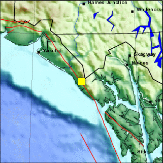
Preferred Hypocentral Solution:
| Local Date: |
Monday February 15th, 2010 |
| Local Time: |
08:29 AM AKST |
| Universal Time: |
02/15/2010 17:29:13.215 UTC |
| Magnitude: |
4.44 ML |
| Latitude: |
58.8357 |
| Longitude: |
-137.6561 |
| Depth: |
1 miles (3 km) |
| Author: |
UAF:dutylap |
This earthquake was:
| 66 miles (105 km) NW of Elfin Cove |
| 74 miles (118 km) WSW of Klukwan |
| 76 miles (121 km) WNW of Gustavus |
| 80 miles (129 km) NW of Pelican |
| 84 miles (134 km) WSW of Haines |
| 88 miles (141 km) ESE of Yakutat |
| 94 miles (151 km) WSW of Skagway |
| 95 miles (152 km) WNW of Hoonah |
| 116 miles (185 km) NW of Tenakee Springs |
| 123 miles (197 km) WNW of Juneau |
| 125 miles (200 km) WNW of Douglas |
| 341 miles (546 km) ESE of Valdez |
| 455 miles (729 km) ESE of Anchorage |
| 530 miles (849 km) SE of Fairbanks |
- 0750: Partly Cloudy but with filtered - heavily
filtered blue in the "clear" areas.
- 0720: Cloudy, very top - top of Mt. Juneau
hidden by clouds on the Channel side, light
precipitation in the inner Gold Creek valley.
- 0705: Light Rain, Cloudy, top of Mt. Roberts,
almost all of the inner Gold Creek valley,
and the SE very top of Mt. Juneau hidden.
- 0700: .04" of Rainfall to this point
today.
- 0650: Cloudy with a few filtered breaks and
thinner spots.
- 0620: Cloudy with a few thinner spots. .04"
of Rainfall to this point today.
- 0436: NWS: A multi-day fog event is possible
late this week into the weekend.
NWS Special Weather Statement
Statement as of 4:36 AM AKST on February 15, 2010

...A multi-day fog event is possible late this week into the weekend...

A strong high pressure system aloft will build north into
Southeast Alaska late this week...and remain over the area through
the weekend. With little or no wind expected in the lower levels
across the central Inner Channels...temperatures will stay cooler
near sea level...and this will lead to a strong temperature
inversion. Fog will likely form Thursday night over the central
Inner Channels and may not dissipate during the daytime Friday.
The fog may persist through the weekend. Depending on exactly how
strong the inversion is and how light winds are...the fog could be
locally dense and may disrupt aviation operations if visibility
drops below Airport minimums for any airports affected by the
fog. Stay tuned to later statements on this potential fog event
later this week.


Rwt
- 0100 AST: High Rain Rate of .02" of
Rain per hour.
SUNDAY 2/14/07: DATA | Valentine's Day | A NWS Wind Advisory
was in effect until 9 PM AST this evening
- See 1741 Below
- 2100 AST: .11" of Rainfall to this point
today.
- 2050: Extremely Light Sprinkling, Cloudy,
clouds skimming Mt. Juneau, very top of Mt.
Roberts in clouds.
- 2020: Light Sprinkling/Misting, Cloudy, clouds
skimming Mt. Juneau; clouds skimming or very
top of Mt. Roberts in clouds.
- 2005: Rain, Cloudy, light wind.
- 1950: Cloudy, a few hints of breaks; clouds
skimming Mt. Juneau and very top of Mt. Roberts
in clouds?
- 1850: Very Light Drizzle/Sprinkling, Cloudy,
clouds skimming Mt. Juneau, very top or very
top - top of Mt. Roberts in clouds.
- 1800: .10" of Rainfall to this point
today.
- 1750: Cloudy, very tops of the mainland mountains
in clouds.
- 1741: The NWS Wind Advisory is now in effect until
9 PM AST this Evening
NWS Wind Advisory
Statement as of 5:41 PM AKST on February 14, 2010

...Wind Advisory now in effect until 9 PM akst this evening...

The Wind Advisory is now in effect until 9 PM akst this evening.

* Wind: southeast wind 20 to 30 mph with gusts to 45 mph in
  exposed locations.

Precautionary/preparedness actions...

A Wind Advisory means that sustained wind speed or frequent gusts
will occur between 40 and 60 mph.

This statement will be updated by 9 PM akst this evening or
sooner if conditions warrant.
- 1720: Very Light Sprinkling, Cloudy, very
top of Mt. Juneau and very top - top of Mt.
Roberts hidden, inner Gold Creek valley substantially
obscured and hidden.
- 1705: Rain, Cloudy, very top of Mt. Juneau
and very top - top of Mt. Roberts hidden,
inner Gold Creek valley substantially obscured
and hidden.
- 1650: Very Light Sprinkling, Cloudy, very
top of Mt. Juneau and very top - top of Mt.
Roberts hidden, inner Gold Creek valley partially
to substantially obscured and hidden.
- 1628: Rain, Cloudy, inner Gold Creek valley
mostly hidden, top of Mt. Roberts, and very
top of Mt. Juneau in clouds.
- 1600: Very Light Rain, Cloudy, very tops
of the mainland mountains in clouds, very
few whitecaps on the Channel.
- 1550: Rain, Cloudy, inner Gold Creek valley
mostly hidden, very top of Mt. Roberts, and
SE part of the top of Mt. Juneau hidden.
- 1535: Very Light Rain, Cloudy, inner Gold
Creek valley mostly hidden, very top of Mt.
Roberts, and very top and SE part of the
top of Mt. Juneau hidden, light wind, some
whitecaps on the Channel.
- 1520: Cloudy, clouds skimming Mt. Juneau
and the Mt. Juneau Ridge, very top of Mt.
Roberts in clouds, light precipitation in
the inner Gold Creek valley, a few whitecaps
on the Channel.
- 1505: Very Light Rain, Cloudy, very top of
Mt. Juneau, upper part of the Mt. Juneau
Ridge, and very top - top of Mt. Roberts
in clouds, remainder of the inner Gold Creek
valley partially obscured, light wind with
occasional gusts, a few whitecaps on the
Channel.
- 1500: .05" of Rainfall to this point
today.
- 1457: Rain, Cloudy, inner Gold Creek valley,
top of Mt. Roberts, and very top and SE part
of the top of Mt. Juneau substantially hidden,
light wind, parts of the remainder of the
mainland partially obscured.
- 1456: High Rain Rate of .07" of Rain
per hour.
- 1450: Very Light Rain, Cloudy, inner Gold
Creek valley, much of the top of Mt. Roberts,
and SE part of the top of Mt. Juneau substantially
obscured-hidden, remainder of the mainland
partially obscured.
- 1435: Very Light Sprinkling, Cloudy, upper
part of the Mt. Juneau Ridge and parts of
the top of Mt. Roberts partially to substantially
obscured, light wind.
- 1408: Rain, Cloudy, top of Mt. Roberts, upper
part of the Mt. Juneau Ridge, and SE part
of the top of Mt. Juneau hidden by clouds,
remainder of the inner Gold Creek valley
partially to substantially obscured, light
wind.
- 1350: Very Light Sprinkling, Cloudy, parts
of the top of Mt. Roberts substantially obscured-hidden.
- 1250: Light Sprinkling, Cloudy.
- 1235: Very Light Rain, Cloudy, inner Gold
Creek valley and part of the top of Mt. Roberts
partially to substantially obscured, light
wind.
- 1200: .01" of Rainfall to this point
today.
- 1157: Very Light Rain.
- 1150: Cloudy, precipitation over parts of
the mainland, inner Gold Creek valley and
part of the top of Mt. Roberts partially
to substantially obscured and hidden, light
to breezy wind, a few whitecaps on the Channel.
- 1105: Very Light Sprinkling, Cloudy, inner
Gold Creek valley and part of the top of
Mt. Roberts partially to substantially obscured
and hidden, light wind with occasional gusts,
a few whitecaps on Gastineau Channel in the
past 10 minutes.
- 1050: Very Light Rain, Cloudy, light wind.
- 1020: Cloudy, a few hints of breaks and brighter
spots.
- 0950: Cloudy, precipitation over parts of
the mainland in the past 5 minutes.
- 0850: Cloudy, brighter.
- 0845:
NWS Wind Advisory
Statement as of 8:45 AM AKST on February 14, 2010

...Wind Advisory now in effect until 6 PM akst this evening...

The Wind Advisory is now in effect until 6 PM akst this evening.

* Wind: southeast wind 20 to 30 mph with gusts to 45 mph in
  exposed locations.

Precautionary/preparedness actions...

A Wind Advisory means that sustained wind speed or frequent gusts
will occur between 40 and 60 mph.

This statement will be updated by noon akst today or sooner if
conditions warrant.
- 0835: A few light sprinkles, cloudy, Granite
Creek area partially obscured.
- 0817: Sprinkling began, Cloudy, slightly
to partially murky in the Granite Creek area.
- 0750: Cloudy/Mostly Cloudy.
- 0735: Cloudy/Mostly Cloudy.
- 0720: Cloudy.
- 0700: .01" of Rainfall to this point
today.
- 0650: Cloudy, light wind.
- 0635: Cloudy, a few breaks.
- 0620 AST: Cloudy. .01" of Rainfall to
this point today.
Sat. 2/13/07: DATA | 1544: NWS Wind Advisory in effect from
11 AM to 6 PM AST Sunday - See 1544 Below
- 2228 AST: High Rain Rate of .04" of
Rain per hour.
- 2100: Trace of Rainfall to this point today.
- 2050: Cloudy.
- 2020: Cloudy, light wind.
- 1950: A few very light sprinkles, cloudy.
- 1920: Cloudy, light wind.
- 1850: Cloudy, Breezy.
- 1800: Trace of Rainfall to this point today.
- 1750: Cloudy, breezy with occasional gusts.
- 1720: Cloudy, breezy with occasional gusts.
- 1650: Cloudy, precipitation in the Granite
Creek area, breezy- windy.
- 1550: Very Light Sprinkling, Cloudy, Granite
Creek area substantially obscured and part
of the top of Mt. Roberts partially obscured,
windy, some whitecaps on the Channel.
- 1544: NWS Wind Advisory in effect from 11 am to
6 PM AST Sunday.
NWS Wind Advisory
Statement as of 3:44 PM AKST on February 13, 2010

...Wind Advisory in effect from 11 am to 6 PM akst Sunday...

The National Weather Service in Juneau has issued a Wind
Advisory...which is in effect from 11 am to 6 PM akst Sunday.

* Wind: southeast wind 20 to 30 mph with gusts to 45 mph in
  exposed locations.

Precautionary/preparedness actions...

A Wind Advisory means that sustained wind speed or frequent gusts
will occur between 40 and 60 mph.

This statement will be updated by 9 PM akst this evening or sooner if
conditions warrant.
- 1500: Trace of Rainfall to this point today.
- 1450: Sprinkling, Cloudy, Breezy, inner Gold
Creek valley and some of the top of Mt. Roberts
partially to substantially obscured and hidden,
a few whitecaps on the Channel.
- 1420: Very Light Sprinkling, Cloudy, Windy,
a few whitecaps on the Channel.
- 1358: Cloudy, Windy, a few whitecaps on the
Channel, some very light sprinkles in the
past 8 minutes.
- 1350: Cloudy, Windy.
- 1320: Cloudy, Windy, a bit of blowing spray
and a few whitecaps on the Channel.
- 1250: Cloudy-Overcast with a few areas of
filtered - heavily filtered blue, windy,
whitecaps on the Channel..
- 1150: Cloudy-Overcast, extremely weak sunshine,
bright spot where the sun is, breezy with
gusts, blowing spray and a few whitecaps
on the Channel.
- 1050: Cloudy, Windy, whitecaps on the Channel.
- 1005: Cloudy, a few very tiny breaks and
bright spots, breezy-windy, some whitecaps
on Gastineau Channel.
- 0950: Cloudy with a few areas of slightly
broken clouds.
- 0930-0935: Wind started picking up.
- 0850: Cloudy with some very small and tiny
breaks.
- 0805: Cloudy with hints of breaks, breaks
and bright areas in the clouds far to the
SE, weak sun on the upper part of West Juneau
and very top of the Mt. Juneau Ridge and
peak of Mt. Juneau, light wind.
- 0750: Cloudy, breaks and yellowish glow far
to the SE, weak yellow-orange glow at the
very top of the Mt. Juneau Ridge and at the
peak of Mt. Juneau.
- 0735: Cloudy, precipitation in part of the
inner Gold Creek valley.
- 0650: Cloudy.
- 0620 AST: Cloudy.
Fri. 2/12/07: DATA | Lincoln's Birthday
- 2100 AST: Very Light Sprinkling, Cloudy.
Trace of Rainfall to this point today.
- 2050: Cloudy, precipitation over parts of
the mainland.
- 1950: Cloudy.
- 1850: Cloudy.
- 1750: Cloudy with a few thinner spots.
- 1650: Overcast - fairly bright sky.
- 1550: Overcast, slight hints - hints of blue.
- 1535: Overcast.
- 1450: Cloudy-Overcast, some slightly filtered
- filtered blue far to the NW.
- 1435: Overcast-Cloudy with some hints of
blue to the NW and some filtered - heavily
filtered blue far to the NW.
- 1353: Overcast with thinnish and thin clouds
with thicker clouds to the SE, streaks and
areas of filtered - heavily filtered blue,
partial halo around the sun, extremely weak
to very weak sunshine.
- 1335: Overcast with thinnish and thin clouds
with some thicker clouds far to the SE, streaks
and areas of filtered - heavily filtered
blue, partial halo around the sun, extremely
weak to very weak sunshine.
- 1250: Thinnish, thin, and very thin clouds
with some slightly filtered to filtered blue,
somewhat weakened sunshine, partial halo
around the sun.
- 1150: Thinnish, thin, and very thin clouds
over most of the sky with slightly filtered
to filtered blue, weak - weakened sunshine.
- 1050: Thinnish, thin, and very thin clouds
over much of the sky, weak - weakened sunshine.
- 0950: Partly Cloudy with very thin clouds
- haze WSW 2/3rds of sky and thinnish, thin,
and very thin clouds ESE 1/3rd, somewhat
weakened sunshine.
- 0935: Clear WSW 2/3rds of sky and thinnish,
thin, and very thin clouds ESE 1/3rd, somewhat
weakened sunshine.
- 0850: Partly Cloudy with high haze and very
thin to thinnish clouds, very weak sunshine.
- 0835: High haze and very, very thin clouds
NW 2/3rds of sky with very thin to thinnish
clouds in the SE 1/3rd, very weak sunshine.
- 0750: Thin - Very Thin Overcast with some
lower clouds in the NW 1/4 - 1/3rd of sky.
- 0650: High thin and very thin clouds and
haze.
- 0620 AST: Mostly Clear SE half of sky and
Cloudy NW half.
Thur. 2/11/07: DATA
- 2050 AST: Cloudy with thinner spots and areas.
- 1950: Cloudy with some breaks and small clear
areas.
- 1850: Cloudy with thinner spots and areas.
- 1750: Cloudy, a few thinner spots.
- 1650: Cloudy.
- 1550: Cloudy.
- 1450: Cloudy, gust of wind in the past 10
minutes.
- 1423: Cloudy, murky around part of the top
of Mt. Roberts and the top of the Mt. Juneau
Ridge in the Granite Creek area.
- 1350: Cloudy.
- 1250: Cloudy.
- 1235: Cloudy, light to breezy.
- 1220: Cloudy, light wind.
- 1150: Cloudy, slight hint of blue overhead,
location of the sun is visible.
- 1120: Cloudy, location of the sun is visible.
- 1050: Cloudy, Breezy.
- 1020: Cloudy, Windy, variable whitecaps on
Gastineau Channel.
- 0950: Cloudy, light to breezy - breezy.
- 0933: The wind is picking up.
- 0850: Cloudy.
- 0750: Cloudy with thinner spots.
- 0650: Cloudy with areas of thinner clouds.
- 0620 AST: Cloudy with some thinner clouds.
- 2050 AST: Mostly Cloudy with slightly filtered
to filtered clear areas.
- 1950: Cloudy with a few filtered breaks and
filtered clear areas.
- 1850: Cloudy with some breaks and filtered
clear areas.
- 1750: Cloudy.
- 1650: Cloudy.
- 1550: Cloudy, a few hints of blue.
- 1450: Cloudy, area of very slightly broken
clouds, fairly bright skies.
- 1420: Cloudy.
- 1350: Cloudy with a few breaks.
- 1335: Cloudy a few filtered breaks and slight
hints of blue.
- 1250: Cloudy with small and tiny breaks,
fairly bright skies, very weak to weakened
sunshine here and there.
- 1150: Cloudy with thinner clouds far to the
NW, a few very small heavily filtered breaks,
fairly bright skies, a few bright and brighter
spots and areas.
- 1120: Cloudy/Mostly Cloudy.
- 1050: Mostly/Partly Cloudy.
- 1020: Mostly/Partly Cloudy, weak - weakened
sunshine on the top of Mt. Juneau.
- 0950: Cloudy with small and tiny breaks,
bright skies with bright clouds in the SE
part, very weak and extremely weak sunshine.
- 0905: Cloudy with small and tiny slightly
filtered - filtered breaks and very small
areas of slightly filtered to filtered blue.
- 0850: Mostly Cloudy with thinnish and thin
clouds and thicker clouds and filtered blue.
- 0750: Cloudy with large areas of thinner
clouds.
- 0650: Cloudy, a few small and tiny filtered
breaks.
- 0633: A New Weekly Picture has been posted - Maple in the Fall.
- 0620 AST: Cloudy.
- 2050 AST: Cloudy. Trace of Precipitation
to this point today. 1/16" - 1/8"
Snowfall today with 0" of Snow on the
ground at 2050.
- 1950: Cloudy.
- 1850: Cloudy.
- 1800: 1/16" - 1/8" Snowfall overnight
with a Trace of Melted Precipitation to this
point today.
- 1750: Cloudy.
- 1650: Cloudy.
- 1550: Cloudy. The Bald Eagle that was in
the tree to the NE along the shore at 1513
is no longer there.
- 1513: One of the two Bald Eagles is back
in the tree to the NE along the shore.
- 1500: 1/16" - 1/8" Snowfall overnight
with a Trace of Melted Precipitation to this
point today.
- 1450: Cloudy. The two Bald Eagles noted at
1227 and at 1350 are no longer there.
- 1350: Cloudy. The two Bald Eagles noted at
1227 are still there.
- 1250: Cloudy.
- 1227: Two Bald Eagles are side by side in
a tree to the NE along the shore.
- 1200: 1/16" - 1/8" Snowfall overnight
with a Trace of Melted Precipitation to this
point today.
- 1150: Cloudy.
- 1050: Cloudy, location of the sun visible.
- 0950: Cloudy.
- 0850: Cloudy, small hint of blue overhead.
- 0820: Cloudy.
- 0750: Cloudy with a few thinner spots with
slight hints of blue.
- 0735: Cloudy with thinner areas with slight
hints of blue
- 0700: 1/16" - 1/8" Snowfall overnight
with a Trace of Melted Precipitation to this
point today.
- 0650: Cloudy.
- 0620 AST: Cloudy. 1/16" - 1/8"
Snowfall overnight with a Trace of Melted
Precipitation. Thin layer of ice on the Bird
Bath.
- 2050 AST: Cloudy. .02" of Rainfall to
this point today.
- 1950: Cloudy with thinner areas.
- 1920: Cloudy with some very small and tiny
breaks.
- 1850: Cloudy with hints of breaks.
- 1800: .02" of Rainfall to this point
today.
- 1750: Cloudy.
- 1650: Cloudy, a few hints of breaks.
- 1635: Cloudy, a few tiny breaks and hints
of, some clouds around part of the Mt. Juneau
Ridge.
- 1550: Cloudy/Mostly Cloudy, a few clouds
around the very top of Mt. Juneau and top
of Mt. Roberts, spots of sunshine on the
top of Mt. Juneau and of Mt. Roberts.
- 1520: Cloudy, a few breaks, spots of sunshine
on Mt. Juneau, precipitation over much of
the mainland, top of Mt. Roberts, part of
the top of the Mt. Juneau Ridge, and SE very
top of Mt. Juneau in clouds.
- 1507: Very brief period of very, very light
snow.
- 1500: .02" of Rainfall to this point
today.
- 1459: Very Light Sprinkling, Cloudy, a few
heavily filtered breaks, clouds skimming
Mt. Juneau and the Mt. Juneau Ridge, SE part
of the top of Mt. Roberts in clouds.
- 1450: Cloudy with a few clear areas, SE part
of the very top of Mt. Juneau, SE part of
the top of Mt. Roberts, and much of the top
of the Mt. Juneau Ridge hidden by clouds,
precipitation in the inner Gold Creek valley.
- 1350: Cloudy with a few breaks.
- 1335: Cloudy SE half of sky and Partly Cloudy
NW half.
- 1250: Cloudy with some breaks, a few spots
of weak sunshine on the mainland, some lower
wisps and bits.
- 1220: Cloudy SE half of sky and Partly Cloudy
NW half, inner Gold Creek valley and top
of Mt. Roberts hidden with precipitation
over Mt. Roberts (snow at the higher elevations)
and in the inner Gold Creek valley.
- 1201: Very Light Rain-Drizzle, Cloudy, a
few breaks, bright clouds in areas, weak
- very weak sunshine.
- 1200: .01" of Rainfall to this point
today.
- 1150: Mostly Cloudy, sun shining, clouds
around parts of the top of Mt. Roberts and
of Mt. Juneau, lower clouds hiding view of
most of the inner Gold Creek valley.
- 1050: Cloudy, a few very tiny breaks and
hints of breaks, bright spot where the sun
is, top of the Mt. Juneau Ridge, very top
of Mt. Roberts, and SE part of the top of
Mt. Juneau in clouds.
- 0950: Mostly/Partly Cloudy, SE part of the
top of Mt. Juneau and very top of Mt. Roberts
in clouds, inner Gold Creek valley partially
obscured and hidden, a few lower wisps, snow
flurries over parts of the mainland, weak
- weakened sunshine.
- 0920: Cloudy with a few breaks, hints of
blue, bright spot where the sun is with extremely
weak sunshine, very top of Mt. Juneau and
much of the top of Mt. Roberts and of the
Mt. Juneau Ridge hidden by clouds.
- 0850: Cloudy/Mostly Cloudy with large area
of slightly filtered to filtered blue, hints
of blue, thinner areas, a few lower clouds.
- 0835: Cloudy/Mostly Cloudy with breaks, and
areas and small areas of slightly filtered
to filtered blue.
- 0750: Cloudy with thinner - thinnish clouds
over much of the sky.
- 0700: .01" of Rainfall to this point
today.
- 0650: Cloudy with some mostly filtered breaks.
- 0620 AST: Cloudy with a few filtered breaks,
cloud hiding the SE part of the top of Mt.
Juneau. .01" of Rainfall to this point
today.
SUNDAY 2/07/07: DATA
- 2050 AST: Cloudy with a very small area of
clear sky. .11" of Rainfall to this
point today.
- 1950: Cloudy.
- 1850: Cloudy.
- 1800: .10" of Rainfall to this point
today.
- 1750: Cloudy.
- 1720: Cloudy, a few small and tiny breaks.
- 1650: Cloudy.
- 1550: Cloudy with a few very small and tiny
breaks, a few thinner spots.
- 1520: Cloudy with somewhat brighter areas
in the clouds.
- 1500: .10" of Rainfall to this point
today.
- 1450: Cloudy.
- 1350: Cloudy.
- 1335: Cloudy.
- 1250: Cloudy, part of the very top of Mt.
Roberts obscured.
- 1200: .10" of Rainfall to this point
today.
- 1150: Cloudy, slightly murky in the inner
Gold Creek valley and around parts of the
top of Mt. Roberts.
- 1120: Rain, Cloudy, very tops of the mainland
mountains in clouds, remainder of the inner
Gold Creek valley partially obscured.
- 1111: Very Light Rain, Cloudy, parts of the
top of Mt. Roberts obscured-hidden.
- 1050: Cloudy.
- 1045: A Bald Eagle is in a tree to the NE
along the shore; still there at 1150.
- 1030: Cloudy, inner Gold Creek valley partially
to totally obscured, murky around parts of
the top of Mt. Roberts.
- 1020: Rain, Cloudy, top of Mt. Roberts in
clouds and some on the Channel side of the
top of Mt. Juneau, inner Gold Creek valley
partially to substantially obscured.
- 0950: Cloudy with some thinner spots.
- 0920: Light Rain (snow at the higher altitudes),
Cloudy, clouds skimming Mt. Juneau, clouds
around parts of the top of Mt. Roberts.
- 0853: Cloudy. A Bald Eagle is in a tree to
the E along the shore.
- 0830: Cloudy, clouds skimming Mt. Roberts,
light wind.
- 0750: Cloudy, clouds skimming Mt. Juneau
and the Mt. Juneau Ridge, very top and parts
of the top of Mt. Roberts in clouds.
- 0700: .06" of Rainfall to this point
today.
- 0650: Very Light Sprinkling, Cloudy.
- 0620: Very Light Sprinkling, Cloudy. .06"
of Rainfall to this point today.
- 0200 AST: High Rain Rate of .02" of
Rain per hour.
- 2100 AST: .22" of Rainfall to this point
today.
- 2050: Light Rain, Cloudy.
- 1950: Sprinkling, Cloudy.
- 1850: Very Light Sprinkling, Cloudy.
- 1800: .20" of Rainfall to this point
today.
- 1746: Rain, Cloudy.
- 1650: Cloudy.
- 1635: Sprinkling, Cloudy.
- 1550: Sprinkling/Very Light Rain, Cloudy.
- 1530: Very Light Rain, Cloudy.
- 1500: .18" of Rainfall to this point
today.
- 1450: Sprinkling, Cloudy, clouds skimming
Mt. Juneau, some lower wisps and bits of
fog Channel side of Mt. Juneau.
- 1420: Rain, Cloudy, clouds skimming Mt. Juneau
and the Mt. Juneau Ridge, clouds skimming
- very top of Mt. Roberts in clouds.
- 1412: High Rain Rate of .10" of Rain
per hour.
- 1350: Very Light Drizzle/Rain, Cloudy, clouds
skimming the mainland mountaintops, a few
lower wisps, light wind.
- 1250: Extremely Light Drizzle, Cloudy, clouds
skimming the mainland mountaintops, parts
of the top of Mt. Roberts substantially obscured-hidden.
- 1200: .13" of Rainfall to this point
today.
- 1150: Rain, Cloudy, some of the top of Mt.
Roberts partially obscured.
- 1131: High Rain Rate of .06" of Rain
per hour.
- 1120: Rain, Cloudy, some lower wisps.
- 1050: Rain, Cloudy.
- 1020: Rain, Cloudy, some of the top of Mt.
Roberts partially to substantially obscured.
- 0950: Very Light Rain, Cloudy, some of the
top of Mt. Roberts partially obscured.
- 0935: Very Light Rain, Cloudy, some of the
top of Mt. Roberts partially obscured.
- 0850: Cloudy, precipitation over the mainland.
- 0750: Extremely Light Sprinkling, Cloudy.
- 0700: .01" of Rainfall to this point
today.
- 0650: Very Light Rain, Cloudy.
- 0620 AST: Very Light Rain/Sprinkling, Cloudy,
light wind. Trace of Rainfall to this point
today.
- 2050 AST: Partly Cloudy. Trace of Rainfall
to this point today.
- 1950: Cloudy with some breaks.
- 1850: Cloudy.
- 1800: Trace of Rainfall to this point today.
- 1750: Cloudy with thinner spots.
- 1650: Cloudy.
- 1635: Cloudy, a few very small and tiny hints
of breaks.
- 1550: Cloudy, a few small and filtered breaks,
clouds in a few areas lit by weak sunshine,
wind blowing in areas.
- 1535: Cloudy, thinner areas, a few small
breaks, wind is picking up, sun is shining
on the SE part of the top of Mt. Roberts.
A Bald Eagle is enjoying the winds aloft.
- 1505: Cloudy with thinner spots and areas,
some very small breaks, spots and areas of
weakened - weak sunshine on the mainland,
some snow blowing at the very top of Mt.
Roberts.
- 1500: Trace of Rainfall to this point today.
- 1449: Cloudy, few hints of blue, break far
to the SE, area of extremely weak sunshine
on the Last Chance Basin side of Mt. Juneau.
- 1420: Cloudy, few tiny hints of breaks.
- 1350: Cloudy.
- 1335: Cloudy.
- 1250: Very Light Sprinkling, Cloudy, murky
in the inner Gold Creek valley and slightly
murky around parts of the top of Mt. Roberts.
- 1220: Sprinkling, Cloudy, snow in the inner
Gold Creek valley (which is partially obscured),
around parts of the top of Mt. Roberts, in
Last Chance Basin, and over part of Mt. Juneau.
- 1205: Sprinkling, Cloudy.
- 1150: Cloudy, slightly murky in the Granite
Creek area.
- 1050: Cloudy.
- 1020: Cloudy.
- 0950: Cloudy with thinner spots and areas
with bright spots, hints of blue, and very
small spots of filtered blue.
- 0850: Cloudy.
- 0750: Cloudy.
- 0650: Cloudy.
- 0620 AST: Cloudy.
Thur. 2/04/07: DATA
- 2050 AST: Clear SE 3/4 of sky and Cloudy
NW 1/4, a few lower wisps and bits. .02"
of Rainfall to this point today.
- 2020: Mostly Clear SE 2/3rds of sky and Cloudy
NW 1/3rd, lower ribbon.
- 1950: Cloudy with a few small and tiny filtered
breaks, cloud hiding the upper Channel side
of Mt. Juneau, lower ribbon.
- 1850: Cloudy with some breaks, lower ribbon.
- 1835: Mostly Cloudy.
- 1800: .02" of Rainfall to this point
today.
- 1750: Light Rain, Cloudy.
- 1745: Rain, Cloudy.
- 1735: Cloudy, ribbon Channel side of Mt.
Juneau and in Last Chance Basin, precipitation
in the form of snow over the upper part of
Mt. Roberts.
- 1650: Cloudy, a few wisps in Last Chance
Basin.
- 1635: Cloudy, ribbon Channel side of Mt.
Juneau, a few wisps in Last Chance Basin.
- 1550: Cloudy, partly cloudy far to the NW,
a few wisps in Last Chance Basin.
- 1500: .01" of Rainfall to this point
today.
- 1450: Cloudy with some breaks.
- 1435: Mostly Cloudy, spots and areas of weakened
- weak sunshine on the mainland.
- 1350: Partly/Mostly Cloudy, sun and weakened
sunshine shining on areas of the mainland.
- 1250: Partly Cloudy, sun here and there,
a few lower bits and wisps Channel side of
Mt. Juneau.
- 1200: .01" of Rainfall to this point
today.
- 1150: Partly Cloudy, sun in and out and here
and there.
- 1105: Partly Cloudy, sun in and out and here
and there, lower ribbon.
- 1050: Mostly Clear NW half of sky and Partly
Cloudy SE half, sun shining , lower ribbon
Channel and Last Chance Basin sides of Mt.
Juneau.
- 1020: Partly Cloudy, lower band Channel and
Last Chance Basin sides of Mt. Juneau, lower
ribbon/band Channel side of Mt. Roberts,
sun shining.
- 0950: Mostly Cloudy, lower band/ribbon.
- 0920: Mostly Cloudy, lower band, sun shining.
- 0905: The Sun is breaking through.
- 0850: Cloudy with small and tiny breaks,
lower band.
- 0835: Cloudy with breaks, lower band, fog/clouds,
and ribbon.
- 0750: Cloudy NW half of sky and broken and
very slightly broken clouds SE half of sky
with orange clouds to the SE, lower band.
- 0720: Cloudy, breaks far to the SE and very
slightly broken clouds in SE part, lower
band Channel side of Mt. Juneau and of Last
Chance Basin.
- 0700: .01" of Rainfall to this point
today.
- 0650: Extremely Light Sprinkling, Cloudy,
lower ribbon.
- 0620 AST: Very Light Rain/Sprinkling, Cloudy,
lower band Channel side of Mt. Juneau and
of Last Chance Basin. .01" of Rainfall
to this point today.
Wed. 2/03/07: DATA | The NWS Summary of January 2010 Weather
- See Below
- 2100 AST: .02" of Rainfall to this point
today.
- 2050: Extremely Light Sprinkles, Cloudy,
fog/clouds hiding the mainland above about
500' - 600'.
- 1950: Cloudy with some filtered breaks, fog/clouds
hiding the mainland above about 800'.
- 1850: A few very light sprinkles, cloudy,
mainland hidden by fog/clouds above about
600' - 800'.
- 1800: .02" of Rainfall to this point
today.
- 1750: Foggy/Cloudy overhead, fog hiding the
mainland above about 450' - 550'.
- 1650: Foggy/Cloudy overhead, fog hiding the
mainland above about 500' - 550'.
- 1550: Foggy/Cloudy overhead, fog hiding the
mainland above about 500' - 650'.
- 1500: .02" of Rainfall to this point
today.
- 1450: Foggy/Cloudy overhead, fog hiding the
mainland above about 500' - 650'. A Bald
Eagle is in a tree to the NE along the shore.
- 1350: Foggy/Cloudy overhead, a few slight
hints of blue, fog hiding the mainland above
about 500' - 650'.
- 1335: Foggy/Cloudy overhead, a few hints
of blue, fog hiding the mainland above about
500' - 700', very weak - extremely weak sunshine
on parts of the mainland.
- 1250: Foggy/Cloudy overhead, a few very slight
hints of blue, fog hiding the mainland above
about 500' - 600'.
- 1200: .02" of Rainfall to this point
today.
- 1150: Foggy/Cloudy overhead with a few hints
of blue, fog hiding the mainland above about
500' - 600'.
- 1050: Cloudy, hints of blue, fog hiding the
mainland above about 400' - 550' with hints
of sunshine in the fog.
- 0950: Cloudy, a few hints of blue, fog hiding
the mainland above about 200' - 350'.
- 0935: Cloudy, a few slight hints of blue,
fog hiding the mainland above about 350'
- 400'.
- 0850: Extremely Light Sprinkling, Cloudy,
hints of blue, fog hiding the mainland above
about 350' - 400'.
- 0750: Very Light Sprinkling, Cloudy, fog
hiding the mainland above about 400' - 450'.
- 0700: .02" of Rainfall to this point
today.
- 0650: Cloudy, fog hiding the mainland above
about 300' - 450'.
- 0637: Now Available: January 2010 Monthly Report, and updated Weather Database.
- 0620 AST: Extremely Light Sprinkling, Cloudy,
fog hiding the mainland above about 250'
- 350'. .01" of Rainfall to this point
today.
- 2100 AST: .03" of Rainfall to this point
today.
- 2050: Extremely Light Sprinkling-Misting,
Cloudy, mainland mostly hidden by fog/clouds
above about 100' - 200'.
- 1950: Very Light Misting, Cloudy, mainland
hidden by fog/clouds above about 150' - 200'.
- 1935: Very Light Misting - Drizzle, Cloudy,
mainland hidden by fog/clouds above about
150' - 200'.
- 1850: Very Light Drizzle, Cloudy, lower band.
- 1800: .02" of Rainfall to this point
today.
- 1750: Cloudy, lower band, precipitation over
at least some of the mainland?
- 1650: Very Light Sprinkling, Cloudy, very
top of Mt. Juneau and very top - top of Mt.
Roberts in clouds, inner Gold Creek valley
substantially obscured-hidden, a few lower
clouds.
- 1620: Cloudy, very top of Mt. Juneau and
parts of the very top - top of Mt. Roberts
in clouds, lower band Channel side of Mt.
Juneau and in Last Chance Basin, thin lower
ribbon Channel side of Mt. Roberts.
- 1600: High Rain Rate of .02" of Rain
per hour.
- 1550: Very Light Drizzle, Cloudy, SE part
of the very top of Mt. Juneau and parts of
the very top - top of Mt. Roberts in clouds,
thin lower ribbons Channel side of Mt. Roberts,
lower band Channel side of Mt. Juneau, fog/cloud
in the lower part of Last Chance Basin.
- 1535: Light - Very Light Rain, Cloudy, SE
part of the very top of Mt. Juneau and parts
of the very top - top of Mt. Roberts in clouds,
thin lower ribbons, fog/cloud in the lower
part of Last Chance Basin.
- 1520: Sprinkling-Very Light Drizzle, Cloudy,
clouds skimming - very top of Mt. Juneau
and of Mt. Roberts obscured-hidden, lower
ribbon with fog/cloud in Last Chance Basin.
- 1500: Trace of Rainfall to this point today.
- 1450: Very Light Sprinkling, Cloudy, clouds
skimming - very top of Mt. Juneau and of
Mt. Roberts obscured-hidden, lower band with
fog/cloud filling much of Last Chance Basin.
- 1350: Extremely Light Sprinkling, Cloudy,
parts of the top of Mt. Juneau and of Mt.
Roberts obscured-hidden, lower ribbon Channel
side of Mt. Juneau and lower band/ribbon
Channel side of Mt. Roberts, fog/cloud filling
much of Last Chance Basin.
- 1320: Cloudy, SE part of the very top of
Mt. Juneau in clouds, a few clouds and murky
around the parts of the top of Mt. Roberts,
lower band Channel side of Mt. Juneau and
ribbon Channel side of Mt. Roberts, fog/cloud
filling much of Last Chance Basin.
- 1250: Extremely Light Misting/Sprinkling,
Cloudy, Mt. Juneau and Last Chance Basin
hidden by fog/clouds above about 400' - 500',
top of Mt. Roberts in clouds with lower ribbon,
snow at the higher elevations.
- 1235: Cloudy, mainland hidden by fog/clouds
above about 450' - 500'.
- 1205: Snowflakes-Raindrops Falling.
- 1200: Trace of Rainfall to this point today.
- 1150: Light Sprinkling, Cloudy, mainland
hidden by fog/clouds above about 400' - 550'.
- 1050: Very Light Sprinkling, Cloudy, Mt.
Roberts hidden above about 550' - 600' on
the Channel side by fog/clouds, ribbon on
Channel side of the top of Mt. Juneau with
a lower band, fog filling most of Last Chance
Basin.
- 0950: Very Light Sprinkles, Cloudy, lower
ribbons and wisps, fog/cloud over Last Chance
Basin.
- 0850: Cloudy, lower ribbon and wisps.
- 0750: Cloudy, clouds skimming the mainland
mountaintops, a few lower bits and wisps.
- 0650: Cloudy, a few lower wisps, an area
of very slightly broken clouds, breaks far
to the SE.
- 0620 AST: Cloudy, very slightly broken clouds
in the SW part of the sky with the Moon illuminating
the clouds.